Hello Friends,
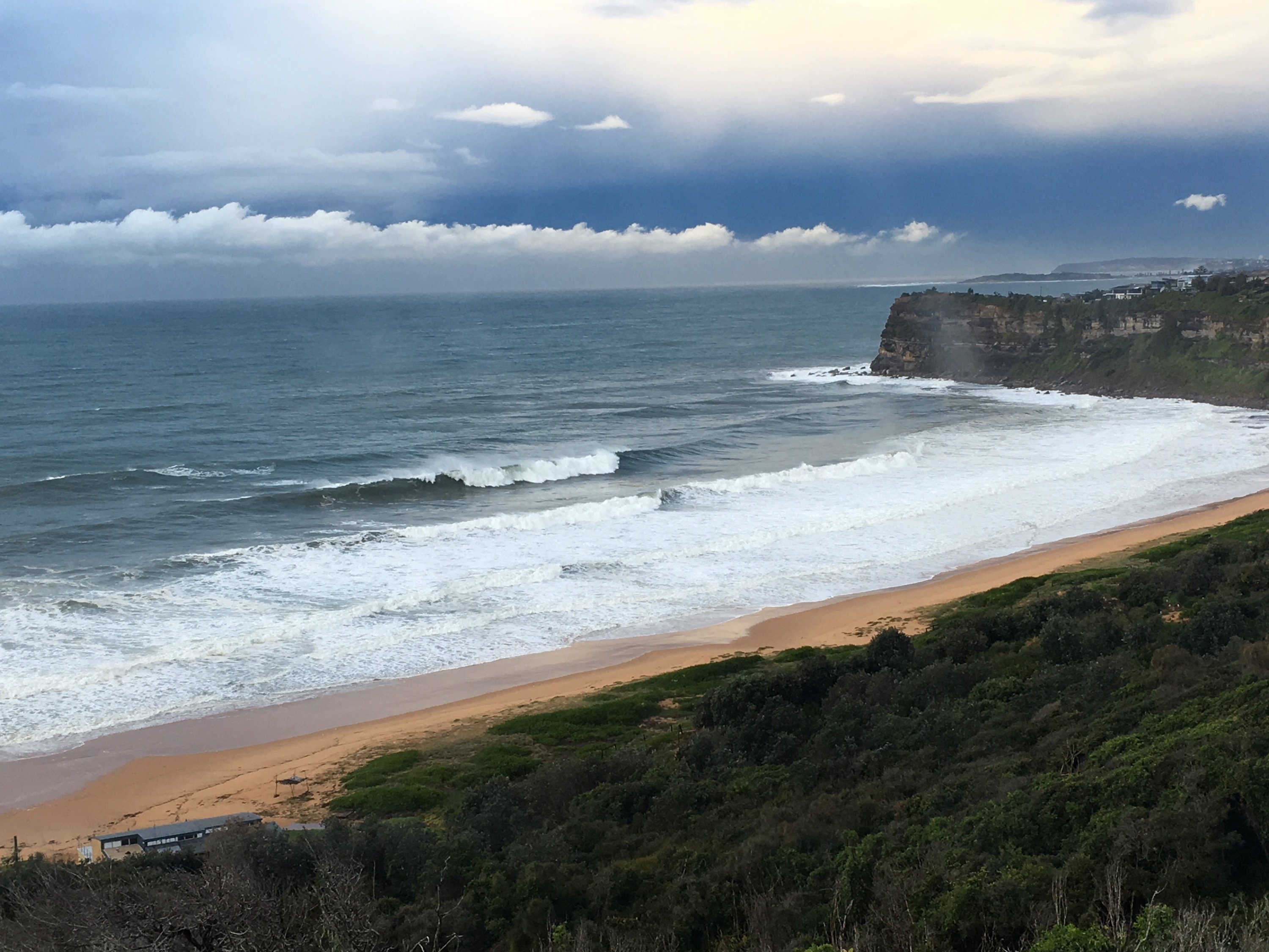
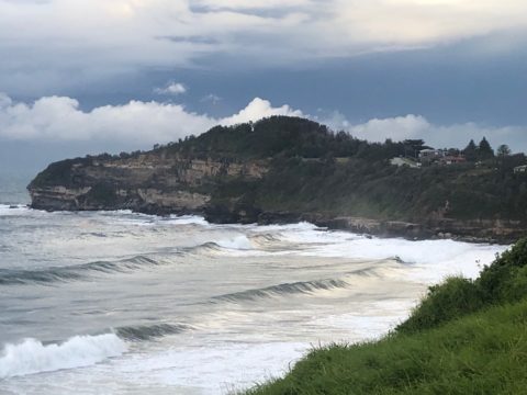
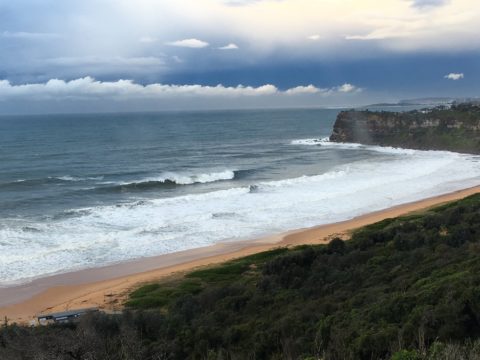
When I climbed aloft to get a pic from the RealSurf crowsnest it was just starting to rain. So I grabbed a phone pic of the rainbow in front of the storm and pulled the hatch closed as the first drops hit. Fortunately, I was sent phone pictures from Warriewood and Bungan (thanks B1 and Dog Walker), which show the swell is still very solid. From the look of the radar the rain train is backed up all the way down to Kiama, so it may be awhile before I can get more pics…
Wind is currently SW 15-20 kts and out at sea, swell is a shade under the 4 metre mark. It’s coming from the SE at 11 seconds apart, so I’d expect exposed spots to be maxed out. There could be something in the corners if you don’t mind icy wind, periods of torrential rain and water that is very likely to be polluted with run off thanks to the 40 mm or so of rain we’ve had in the last 24 hours. Ocean temp is still on 22C, which is scary in its own way.
Tomorrow should see a return of the sunshine along with SW wind in the morning and more approachable (ie smaller) surf conditions. Not sure about the water though…
Friday looks like seeing the south swell pulse up again into the challenging range. Wind call is for southerlies though.
Saturday could be fun as the weather gets sunny, the wind mellows out and the swell drops into the fun range (I’m hoping chest plusses at better spots).
Sunday into the new week currently looks unpromising on the models. In fact, it looks dire from here… but we’ll see what the Goat says tomorrow afternoon.
Have a great day one and all!

Hello Friends,
Warriewood – wild, woolly but worthwhile.
Bungan – unruly and unpopulated.
Weather Situation
As the low pressure system moves further away from New South Wales winds will ease in response. The introduction of a high pressure system over the coming days will keep winds along the coast in a southerly regime, though substantially less intense than we have seen in past. Hazardous surf conditions will continue across much of the coastline today and for northern parts of the coast tomorrow.
Forecast for Wednesday until midnight
Strong Wind Warning for Wednesday for Sydney Coast
Winds
Southerly 15 to 25 knots, reaching up to 30 knots during the morning.
Seas
2 to 3 metres, decreasing to 1.5 metres during the afternoon.
Swell
Southerly 4 metres, decreasing to 3 metres around midday, then tending southeasterly 2.5 to 3 metres during the afternoon.
Weather
Partly cloudy. 95% chance of showers. The chance of a thunderstorm.
Caution
Surf conditions may be more powerful than they appear and are expected to be hazardous for coastal activities such as crossing bars by boat and rock fishing.
Thursday 6 June
Strong Wind Warning for Thursday for Sydney Coast
Winds
Southwesterly 15 to 20 knots turning south to southeasterly 20 to 25 knots in the evening. Winds reaching up to 30 knots in the evening.
Seas
1 to 1.5 metres, increasing to 2 to 2.5 metres by early evening.
Swell
South to southeasterly 2 to 3 metres inshore, increasing to 3 to 4 metres offshore by early evening.
Weather
Mostly sunny.
Friday 7 June
Winds
Southerly 15 to 20 knots turning southeasterly below 10 knots during the afternoon.
Seas
1 to 2 metres, decreasing to 1 metre during the afternoon.
Swell
Southerly 3 to 5 metres, decreasing to 2.5 to 3 metres during the afternoon or evening.
Weather
Partly cloudy.

