Hello Friends,
Swell should build dramatically. I haven’t had time to take a picture yet, but sets at exposed spots are solidly head to head and a bit this morning. Swell was SSE 2.8 metres at close to 14 seconds as of 0500 at the Sydney MHL buoy. As of 0700 the wind at North Head was still westerly at 10-13 kts – but the Bureau has a gale warning up, so the wind’s going to swing SW soon as it heads toward the 25-35 kt zone. First tide of the day was a low at 0615 and we’re currently heading toward a 1.4 m high at 1240 – by which time the swell should be rumbling as it builds to peak intensity this afternoon.
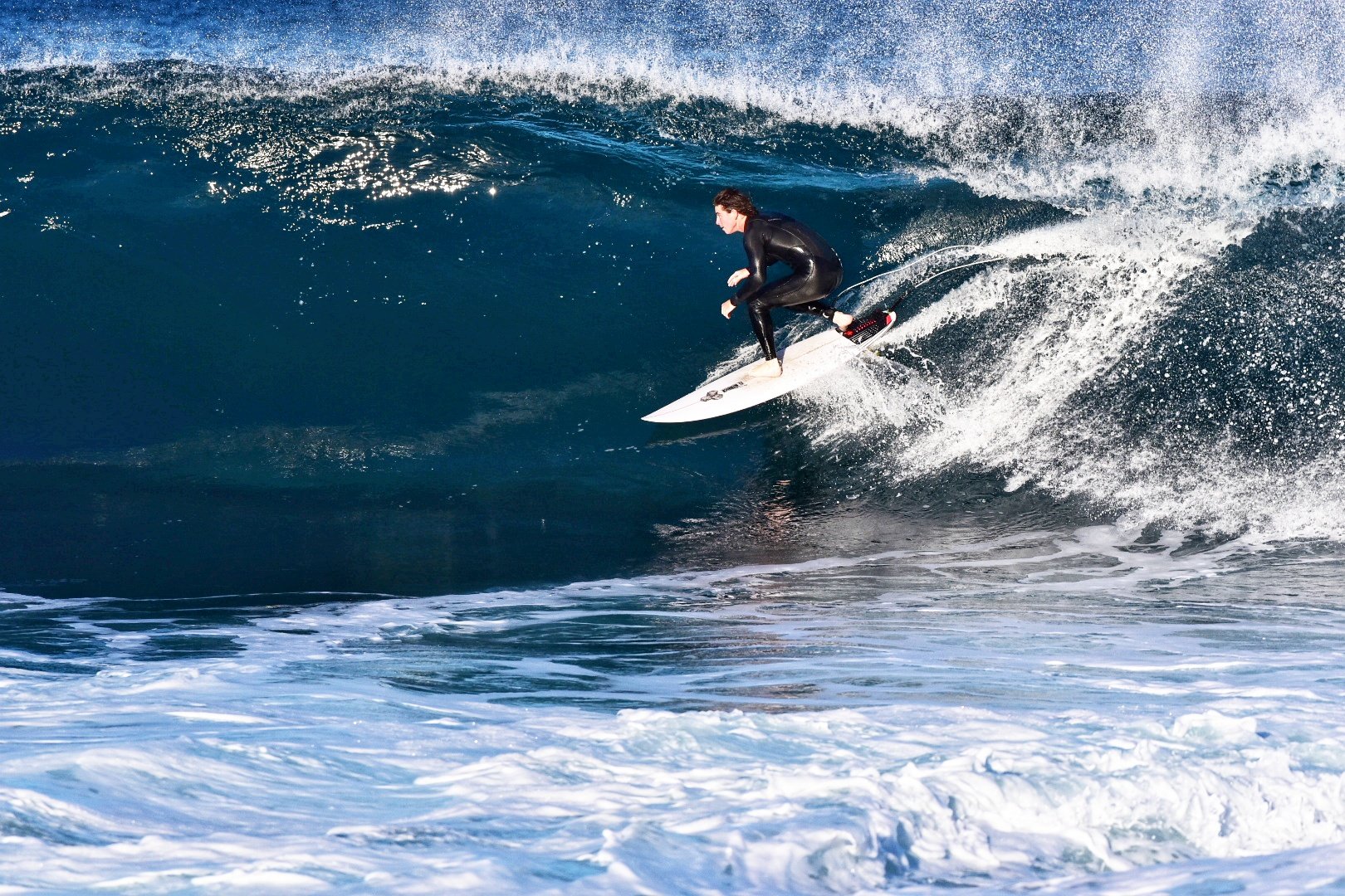
I will be out and about with the camera soon, so expect a piccie or two as the morning progresses. Meanwhile, here’s a shot from yesterday afternoon at the point…
.
Weather Situation
A strong high pressure system is centred over the Bight while a series of cold fronts skim across southeast Australia, associated with a deep low to the south. This pattern is bringing vigorous winds and powerful swells to the New South Wales coast, with the worst of the conditions expected in most coastal areas later today. The last of the fronts will clear the region tonight, after which the high will drift across from the west. Winds will ease heading into Friday, although the swell will linger into the weekend.
Forecast for Thursday until midnight
Gale Warning for Thursday for Sydney Coast
- Winds
- Westerly 20 to 30 knots turning south to southwesterly 25 to 35 knots in the morning, reaching 40 knots offshore.
- Seas
- .2 to 3 metres, increasing to 3 to 5 metres during the day.
- Swell
- Southerly 3 to 5 metres, increasing to 6 to 8 metres around midday.
- Weather
- Partly cloudy. 50% chance of showers.
- Caution
- Large and powerful surf conditions are expected to be hazardous for coastal activities such as crossing bars by boat and rock fishing.
Friday 23 August
Strong Wind Warning for Friday for Sydney Coast
- Winds
- Southwesterly 15 to 25 knots, reaching 30 knots offshore at first, becoming variable about 10 knots in the afternoon then northerly 15 to 20 knots in the evening.
- Seas
- 2.5 to 3 metres, decreasing to 1.5 to 2 metres during the morning, then decreasing to 1 metre around midday.
- Swell
- Southerly 4 to 6 metres, decreasing to 3 to 4 metres around midday.
- Weather
- Partly cloudy.
- Caution
- Large and powerful surf conditions are expected to be hazardous for coastal activities such as crossing bars by boat and rock fishing.
Saturday 24 August
- Winds
- North to northwesterly 15 to 20 knots turning westerly 10 to 15 knots during the afternoon.
- Seas
- Around 1 metre, increasing to 1 to 1.5 metres offshore.
- Swell
- Southerly 2 to 3 metres, decreasing to 1.5 to 2 metres during the morning.
- Weather
- Sunny.
- Caution
- Large and powerful surf conditions are expected to be hazardous for coastal activities such as crossing bars by boat and rock fishing

