
Hello Friends,
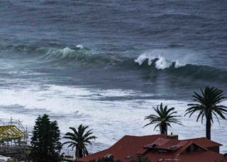
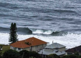
Another 3-15mm of rain possible along the coast today as we head to a high of around 19. Water quality looked pretty bad and yesterday morning, before another solid day of rain, Beachwatch was warning pollution was possible at all Sydney beaches. Plus Warriewood STC had an overflow event. I’m leaving the microbial stew alone myself. But then again, it’s not a tough choice given the strictly ordinary conditions on offer this morning. At report writing time the wind was SSE 12-18 kts and the MHL buoy was showing 3 metres of 9-second jumbled junk from the SSE (154°).
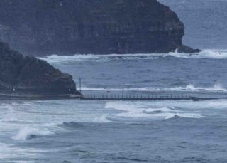
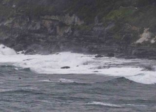
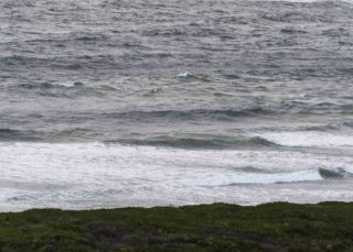
The only place I saw people in the water was at Dee Why point (see pic below) where it looked to be in the chest to shoulder plus range. Not that it matters much, but the morning high tide is at 0845 (1.6m) and low is at 1430. Water temp has come back up a bit and is on 18C.
Tomorrow the ECM and Wavewatch both project 1.3 metres in the morning from the E-ESE at 7-8 seconds. Weather call is for mostly sunny with light winds too, so could be okay for a Dad’s day paddle. The rest of the week could have little waves off and on through to about Thursday when the models say to expect very small and marginal into the weekend. At this stage the long range models are projecting a 3 metre-ish south pulse at the weekend – ECM says close to 4m on Sunday while Wavewatch says 3 plus from Saturday.
Have a good one!
Weather Situation
A broad low pressure trough lies over the western Tasman Sea, while a high pressure system over Bass Strait extends a ridge to the southern Tasman sea. The trough is expected to linger about the western Tasman Sea during the next couple of days as the high moves east over the southern Tasman Sea. On Sunday the trough moves away to the east as another high moves over New South Wales from the west.
Forecast for Saturday until midnight
Strong Wind Warning for Saturday for Sydney Coast
Winds
Southeasterly 15 to 25 knots, reaching up to 30 knots offshore during the morning. Winds decreasing to 10 to 15 knots in the late evening.
Seas
1.5 to 2.5 metres, decreasing to 1 to 1.5 metres during the afternoon.
1st Swell
Southeasterly 1.5 metres, tending easterly 1.5 metres during the morning, then increasing to 2 metres around midday.
2nd Swell
Southerly around 1 metre.
Weather
Cloudy. 80% chance of showers. The chance of a thunderstorm.
Sunday 1 September
Winds
South to southeasterly 10 to 15 knots turning southwesterly during the morning then becoming variable about 10 knots in the middle of the day.
Seas
Around 1 metre.
Swell
Easterly 1.5 to 2 metres, decreasing to 1.5 metres during the morning, then decreasing to around 1 metre during the afternoon.
Weather
Mostly sunny.
Monday 2 September
Winds
North to northwesterly about 10 knots tending west to southwesterly 15 to 20 knots during the morning then turning southerly during the day.
Seas
Around 1 metre, increasing to 1 to 1.5 metres offshore during the afternoon.
Swell
Easterly around 1 metre, increasing to 1 to 1.5 metres during the morning.
Weather
The chance of a thunderstorm in the morning. Sunny afternoon

