
Hello Friends,
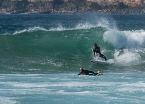
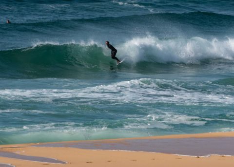
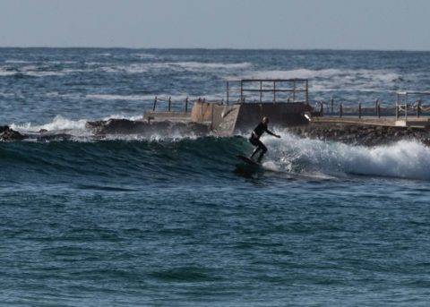
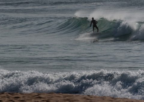
Definitely some swell around this morning, but high tide was 1.6m, so conditions at Dee Why and Curly were both strongly affected. Wind swung around to the NE by 0900 too, so the offshore conditions in the two Dee Why snaps have now been replaced with beat-up looking onshore slop. Should still be an option or two in the north corners through the day. Next tide’s a low at 1435.
Stay safe and keep an eye on the weather warnings as a strong cold front is due tomorrow with hot winds ahead of it.
TOP PRIORITY FOR IMMEDIATE BROADCAST
Severe Weather Warning
for DAMAGING WINDS
Weather Situation: A strong cold front will move through New South Wales and the ACT on Tuesday, with vigorous northwesterly winds expected ahead of the front over the southern ranges and Illawarra. The front will also bring a gusty southerly buster to the coastal fringe of the Illawarra, Sydney and Hunter districts in the late afternoon and evening.
For Tuesday: DAMAGING WINDS, averaging 60 to 70 km/h with peak gusts in excess of 90 km/h, are possible over the Snowy Mountains district, Illawarra districts, eastern parts of the Southern Tablelands district, parts of the South Coast district and southern parts of the ACT. For Alpine areas above 1900 metres DAMAGING WINDS, averaging 80 to 90 km/h with peak gusts in excess of 110 km/h, are expected.
For Tuesday evening: DAMAGING WINDS, averaging 60 to 70 km/h with peak gusts in excess of 90 km/h, are possible along the coastal fringe of the Sydney Metropolitan and Hunter districts (including the coastal fringe of the Central Coast).
Winds are expected to ease by Wednesday.
Locations which may be affected include Sydney, Wollongong, The Entrance, Nowra, Bowral, Braidwood, Goulburn, Cooma, Thredbo and Bombala.
The State Emergency Service advises that people should:
* Move vehicles under cover or away from trees.
* Secure or put away loose items around your house, yard and balcony.
* Keep at least 8 metres away from fallen power lines or objects that may be energised, such as fences.
* Report fallen power lines to either Ausgrid (131 388), Endeavour Energy (131 003), Essential Energy (132 080) or Evoenergy (131 093) as shown on your power bill.
* For emergency help in floods and storms, ring your local SES Unit on 132 500.
The next Severe Weather Warning will be issued by 5:00 pm AEDT Monday.
Weather Situation
Winds will gradually shift north to northeasterly as a high pressure system moves from southeast Australia over the Tasman Sea, and a cold front approaches from the west. This front will bring a vigorous southerly change to southern and central waters on Tuesday, and to northern waters early Wednesday.
Forecast for Monday until midnight
Strong Wind Warning for Monday for Sydney Coast
Winds
Southerly 10 to 15 knots becoming variable about 10 knots early in the morning then becoming north to northeasterly 15 to 25 knots in the afternoon. Winds reaching up to 30 knots in the late evening.
Seas
1 to 1.5 metres, decreasing below 1 metre during the morning, then increasing to 1.5 to 2.5 metres around midday.
Swell
Southerly 1.5 to 2.5 metres, decreasing to 1.5 metres by early evening.
Weather
Partly cloudy.
Tuesday 12 November
Gale Warning for Tuesday for Sydney Coast
Winds
Northerly 20 to 30 knots decreasing to 15 to 25 knots before dawn then shifting southerly 25 to 35 knots in the evening.
Seas
1.5 to 2.5 metres, decreasing to 1 to 1.5 metres during the morning, then increasing to 1.5 to 2 metres by early evening.
1st Swell
Southerly 1 to 1.5 metres, decreasing to around 1 metre during the morning.
2nd Swell
North to northeasterly around 1 metre.
Weather
Mostly sunny.
Wednesday 13 November
Winds
Southerly 15 to 25 knots tending southwesterly 15 to 20 knots during the morning then turning west to northwesterly 10 to 15 knots during the evening.
Seas
2 to 3 metres, decreasing to 1 to 1.5 metres during the morning.
1st Swell
Southerly below 0.5 metres, increasing to 1.5 to 2.5 metres during the morning.
2nd Swell
Northeasterly 1 to 2 metres, decreasing to around 1 metre during the morning.
Weather
Mostly sunny.

