
Hello Friends,
The short version: stay in bed.
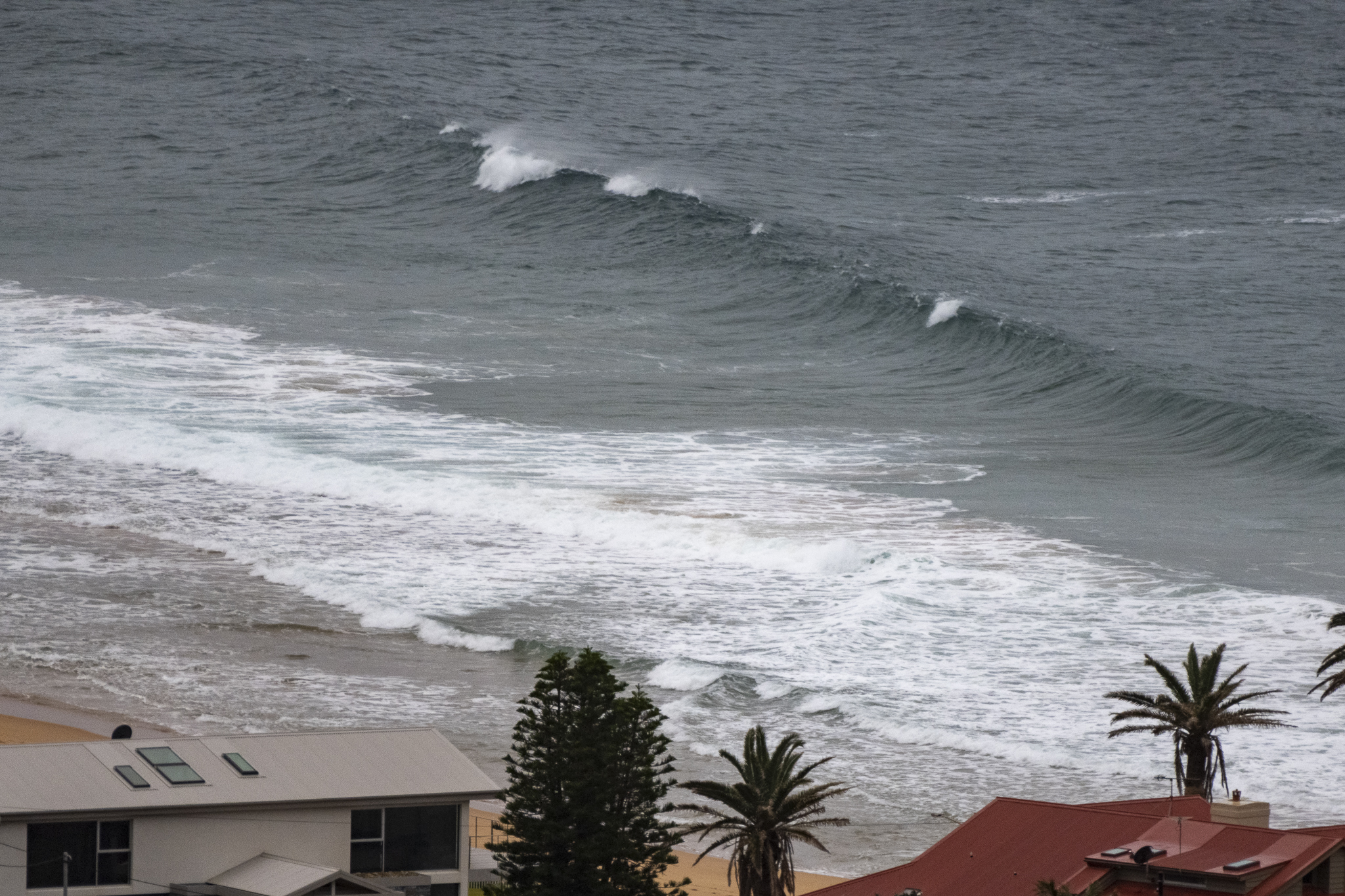
Saturday kicked off with grey, rainy skies, blustery SSW wind and a weak looking 1.4 metre, 9 second SE swell offering little of interest to surfers. There were a few stalwarts braving the elements at Dee Why point, but it looked to be just barely into the catchable range on sets and quality was, as you can see, strictly ordinary.
Conditions don’t look like improving until Wednesday morning. Between then and now it seems we can expect relentless southerly wind and rainy weather. Here’s hoping I’ll be proven spectacularly wrong!
Have a great Saturday one and all!


Weather Situation
The remnant of a cold front is stalling about the north coast while a low pressure system is forming off the far southern Queensland coast. Gale force southerly winds and hazardous surf conditions with large and powerful waves will develop along the northern half of the coast by late this afternoon as the two features combine and deepen through the weekend. Winds will then gradually ease during Monday and Tuesday as the low moves away to the east.
Forecast for Saturday until midnight
Strong Wind Warning for Saturday for Sydney Coast
- Winds
- Southeasterly 25 to 30 knots.
- Seas
- 2.5 to 3 metres.
- Swell
- Southerly 2 to 2.5 metres, tending southeasterly 2 metres later in the evening.
- Weather
- Cloudy. 95% chance of showers.
Sunday 4 September
Strong Wind Warning for Sunday for Sydney Coast
- Winds
- Southeasterly 25 to 30 knots tending south to southeasterly 20 to 25 knots in the evening.
- Seas
- 2 to 2.5 metres.
- Swell
- Southeasterly 2 to 2.5 metres.
- Weather
- Partly cloudy. 80% chance of showers.
Monday 5 September
- Winds
- Southerly 15 to 25 knots.
- Seas
- 1.5 to 2 metres.
- Swell
- Southeasterly 2.5 metres, tending southerly 2.5 metres during the evening.
- Weather
- Partly cloudy. 90% chance of showers.


