Hello Friends,
UPDATE:

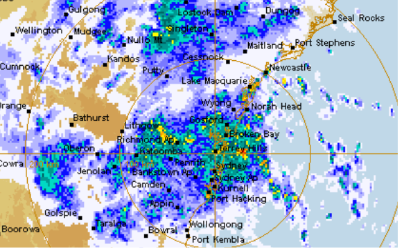
It’s obviously not a day for beach activities. It was raining steadily as Friday got started and the Bureau says it’s going to get heavier as the day goes along. The wind was SSE 14-21 kts as of 0800 and the Botany Bay offshore buoy was seeing 3.2 metres of 5-sec period junk from the SE. As you’ll see from the Marine Forecast below, the wind and wild conditions are set to continue through tomorrow. But, water quality not withstanding, Sunday could see a return to more benign conditions with potentially offshore wind in the morning and around 2 metres of mainly east swell in the 9 second range…
Stay dry, stay safe and have a great Friday!
Weather Situation
An inland and a coastal trough are building today with a low pressure system expected to form over the central slopes. During the same period the coastal trough is expected to deepen somewhat and move steadily south with a small, transient coastal low likely in the trough, and with winds south of the trough expected to strengthen. The coastal low and trough are expected to move further south through Saturday with the strong winds contracting south. A ridge will build along the northwest early next week and there is potential for another rough to build in the southeast.
Forecast for Friday until midnight
Gale Warning for Friday for Sydney Coast
- Winds
- Easterly 15 to 25 knots increasing to 20 to 30 knots in the middle of the day. Winds reaching up to 35 knots during the afternoon and evening.
- Seas
- 1 to 2 metres, increasing to 2 to 3 metres around midday.
- 1st Swell
- Easterly around 1 metre, increasing to 1.5 to 2 metres during the morning, then increasing to 2.5 to 3 metres during the afternoon.
- 2nd Swell
- Southerly 1 to 1.5 metres, decreasing to around 1 metre around midday, then increasing to 1.5 metres by early evening.
- Weather
- Cloudy. Near 100% chance of rain. Heavy falls possible. The chance of a thunderstorm.
- Caution
- Large and powerful surf conditions are expected to be hazardous for coastal activities such as crossing bars by boat and rock fishing.
Saturday 6 April
Gale Warning for Saturday for Sydney Coast
- Winds
- East to northeasterly 25 to 30 knots, reaching up to 35 knots early in the morning. Winds tending north to northeasterly 15 to 25 knots during the morning.
- Seas
- 2 to 3 metres, decreasing to 1 to 2 metres around midday.
- 1st Swell
- Easterly 2 to 3 metres.
- 2nd Swell
- Southerly 1.5 metres, decreasing to around 1 metre during the morning.
- Weather
- Cloudy. 95% chance of rain. The chance of a thunderstorm.
- Caution
- Large and powerful surf conditions are expected to be hazardous for coastal activities such as crossing bars by boat and rock fishing.
Sunday 7 April
- Winds
- North to northwesterly 15 to 20 knots turning westerly 10 to 15 knots during the evening.
- Seas
- 1 to 1.5 metres, decreasing below 1 metre during the morning.
- 1st Swell
- Northeasterly 1.5 to 2.5 metres, decreasing to 1.5 metres during the evening.
- 2nd Swell
- Southerly around 1 metre inshore, increasing to 1 to 1.5 metres offshore during the morning.
- Weather
- Mostly sunny. The chance of a thunderstorm.


