Hello Friends,
Wind was still WSW at daybreak in Sydney, but the forecast is for southerly wind and rain today. The MHL buoy was seeing 3.2 metres of 9-second bump from the SSE as of 0500. That period is on the short side to refract into protected corners though, which makes me think finding anything resembling a reasonable wave will be quite a challenge.
Right now the prospects do not look like improving before mid week in Sydney. Lots of southerly to easterly wind in the models, sadly.
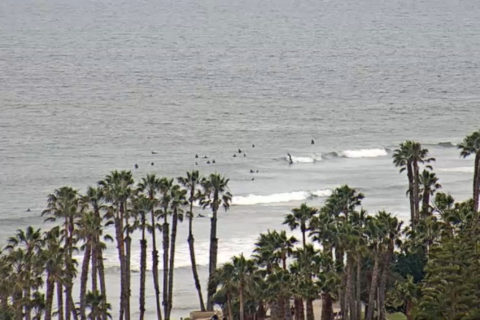
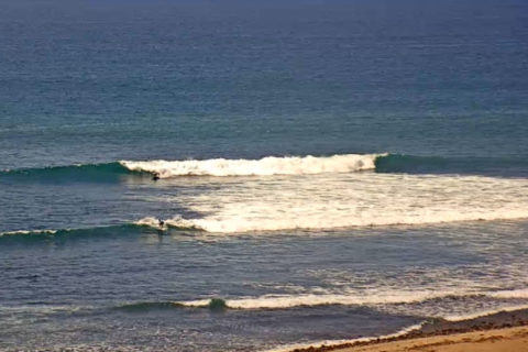
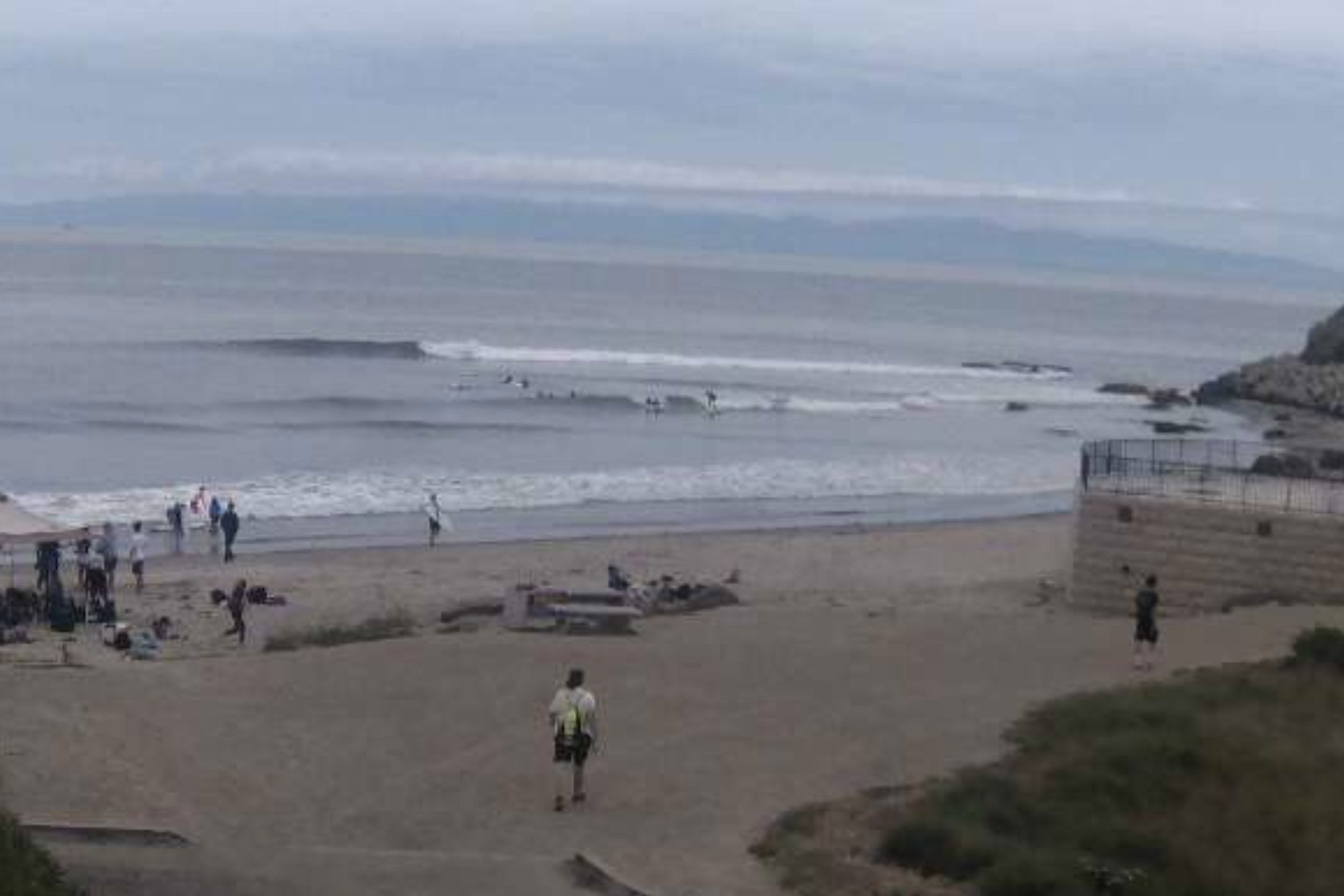
While there are fun size waves down south in Orange and San Diego counties, up the coast in Ventura and Santa Barbara we’re still in a holding pattern with flatness for the latter and marginal knee high dribble for the former until the end of next week.
Have a good Saturday one and all!
Weather Situation
A high pressure system lies over southeast Australia for the remainder of the week, before shifting into the southern Tasman Sea on Monday. This will maintain mostly southeast to southwesterly winds over New South Wales waters.
Forecast for Saturday until midnight
Strong Wind Warning for Saturday for Sydney Coast
- Winds
- Southerly 20 to 25 knots, reaching up to 30 knots during the day.
- Seas
- 2 to 3 metres.
- Swell
- Southerly 2 to 2.5 metres.
- Weather
- Cloudy. 95% chance of showers. The chance of a thunderstorm offshore.
Sunday 23 June
Strong Wind Warning for Sunday for Sydney Coast
- Winds
- Southerly 15 to 25 knots, reaching up to 30 knots early in the morning. Winds tending southeasterly in the early afternoon.
- Seas
- 2 to 3 metres.
- Swell
- Southerly 2 to 2.5 metres, tending southeasterly 1.5 to 2 metres later in the evening.
- Weather
- Cloudy. 95% chance of showers. The chance of a thunderstorm offshore.
Monday 24 June
- Winds
- Southeasterly 15 to 20 knots.
- Seas
- 1 to 1.5 metres.
- Swell
- Southerly 2 metres, tending southeasterly 2 metres during the morning.
- Weather
- Partly cloudy. 90% chance of showers. The chance of a thunderstorm in the morning.
POSTCARDS FROM CALI