
Hello Friends,
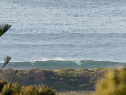
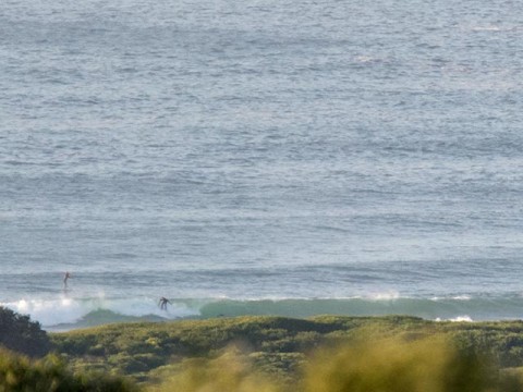
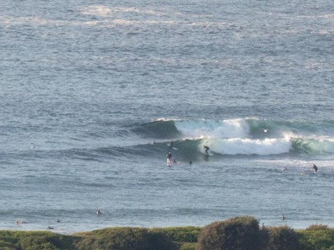
Light offshores and 1.5 metres of 11-sec ESE swell under sunny skies as Wednesday got started at Dee Why. Lots of keen folks in the water within an hour of sunrise on the dropping tide (it’s low at 1125).
It seems to be less consistent than yesterday at this time, but set wave faces were still in the shoulder to maybe plus range. The point and the beach seemed to be similar size, but the latter continues to look like mostly offering an endless succession of shutdowns. Where are the peaks??
The Bureau (and the models) expect the swell to gradually decrease across the day and for the wind to gradually come around to the NE. So, if you can’t get in until the late, it’ll be protected north corners only.
As usual the various swell prediction models are pointing this way and that. Broadly speaking they mostly project a few little waves around the joint tomorrow morning, then pretty marginal for Friday and getting very small to flat by Saturday morning. Beyond that things are shaping up nicely in the computers’ calculation of probabilities. If they have it right, from Monday onward we should have swell energy from the SE, but with onshores at first. However, if the long-range predictions have anything to do with reality, the swell should get real interesting from around Wednesday through to maybe Friday morning.
Have yourself a great Wednesday one and all and keep on smilin’!
Weather Situation
A high is centred over the Tasman Sea. A cold front is expected to reach the south coast Thursday morning bringing southerly winds which should then extend north along the coast before stalling on the Mid- North coast on Friday. The next cold front is expected to affect the south coast later Saturday and the remainder on Sunday.
Forecast for Wednesday until midnight
- Winds
- North to northeasterly about 10 knots increasing to 15 to 20 knots in the morning.
- Seas
- Below 1 metre, increasing to around 1 metre during the morning, then increasing to 1.5 to 2 metres by early evening.
- Swell
- Southerly 1.5 to 2 metres, decreasing to 1.5 metres by early evening.
- Weather
- Mostly sunny.
Thursday 16 April
- Winds
- Northerly 15 to 20 knots shifting southeasterly in the late afternoon.
- Seas
- 1 to 2 metres, decreasing to 1 metre around midday, then increasing to 1 to 1.5 metres by early evening.
- Swell
- South to southeasterly 1 to 1.5 metres.
- Weather
- Mostly sunny. 20% chance of a shower.
Friday 17 April
- Winds
- Southeasterly 15 to 20 knots turning east to northeasterly below 10 knots during the evening.
- Seas
- 1 to 1.5 metres, decreasing to 1 metre during the morning.
- Swell
- South to southeasterly around 1 metre.
- Weather
- Cloudy. 20% chance of a shower.

