
Hello Friends,
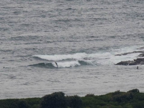
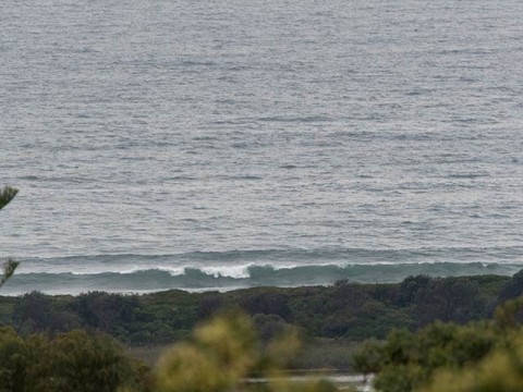
Despite the MHL buoy reporting 1.8 metres of 11-sec SE swell out at sea and the wind coming from the SSW, Dee Why looked pretty weak and messy under cloudy skies at 0700. There were a few bods in the water at the point (see pic below) but the waves looked more like feeble beachbreak than anything else. Up the beach toward No Man’s, there were similar messy lines and no takers that I could see. My guess is that wave faces – such as they are – are in the waist to chest range.
Wind is set to move around to the SE soon and to be into the 10-15 kt range, with occasional heavy showers.
Next tide is a low at 1155.
If you’re thinking of a splash anyway, it’s worth knowing that yesterday’s rain has already pushed Bilgola, Newport, Collaroy, Longy to Dee Why, North Curly and Freshy to the Bower are all shown as “pollution possible” on the Beachwatch site this morning. Given that the forecast is for rain through to Sunday, I’d expect the list of dodgy water locations will get longer.
The Bureau is warning of large and powerful surf conditions for tomorrow in Sydney. Looking at the models, it would seem that we’re likely to see some longish (14-sec) period energy from the south for a few daylight hours early tomorrow. My hunch is that we’re going to see occasional bomb sets in the mix, but not much more. Throw in the rain, woofy water and 15-20 kts of easterly and I don’t think much of our chances.
Outlook beyond tomorrow is not too flash in my view. I think we may have to wait until Sunday or Monday for conditions to come together for us. Be interesting to see what the Goat says later today.
Have a top old day one and all!
Weather Situation
A strong high pressure system centred near Tasmania is slowly moving east and is expected to move into the Tasman Sea later today, with winds shifting from southeasterly to east to northeasterly. A low pressure trough will develop near northeastern New South Wales today as the high moves east across the southern Tasman Sea. The trough is expected to move offshore during Friday and deepen into a low off the southern Queensland coast before the low moves slowly southwards to lie off the NSW north coast and eventually move away from the coast on Sunday.
Forecast for Thursday until midnight
Winds
Southeasterly 10 to 15 knots tending easterly in the evening.
Seas
Around 1 metre.
Swell
Southerly 1.5 metres.
Weather
Cloudy. 90% chance of showers. The chance of a thunderstorm, heavy at times.
Friday 1 May
Winds
Easterly 15 to 20 knots.
Seas
Around 1 metre, increasing to 1 to 2 metres by early evening.
Swell
Southerly 1.5 metres, increasing to 1.5 to 2 metres during the morning, then tending south to southeasterly 1 to 1.5 metres by early evening.
Weather
Cloudy. 90% chance of rain. The chance of a thunderstorm.
Caution
Deceptively powerful surf conditions are expected to be hazardous for coastal activities such as crossing bars by boat and rock fishing.
Saturday 2 May
Winds
Northeasterly 15 to 20 knots turning easterly 10 to 15 knots during the afternoon.
Seas
1 to 1.5 metres.
1st Swell
Easterly 1 to 2 metres, tending northeasterly 2 to 2.5 metres during the afternoon.
2nd Swell
Southerly around 1 metre.
Weather
Cloudy. 90% chance of rain. The chance of a thunderstorm.


