Hello Friends,
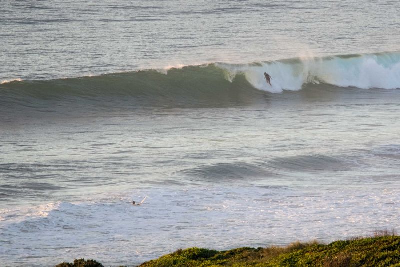
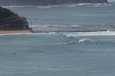
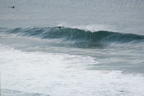
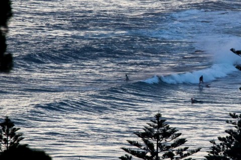
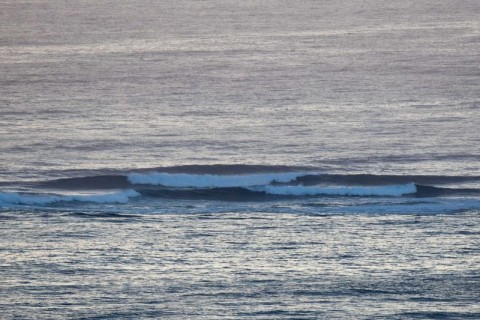
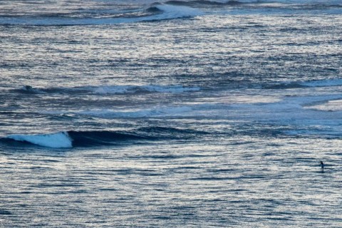
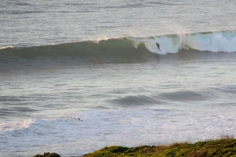
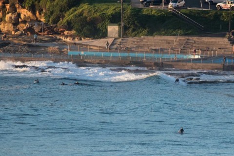
Thumping swell as predicted at the east magnets this morning. Swell’s out of the east at about 1.5 metres but with a juicy 12+ sec period. Set wave faces at the standouts are into the head plus range and almost certainly will be bigger on the bombs. By 0615 anywhere with a wave was looking well populated. There were bods in the water from south of carparks to – and including – Northy. Looked like quality up that way. The smooth surface conditions were making south Narrabeen look pretty shapely, but as usual, the board-snapping shutdowns outnumbered the makeable ones. Collaroy had some waist-ish options for cruisers and beginners. Whiterock was unoccupied and only a possibility. Makaha was interesting too. Around the corner there were solid head high sets from about the lugga south to the surf club. The point was showing a little bit, but it was much less consistent and smaller than the beach.
You’ve got to get on it asap, because the light offshores of the early morning are set to give way to rapidly accelerating southerly wind soon. It’s likely to be blown out before lunch according to the Bureau.
Tide’s coming into the high at 0840
Swell looks like peaking today but there should be energy into the middle of next week. The big problem is going to be the wind. The southerly conditions look like being annoying tomorrow and maybe slightly less annoying on Monday. Beyond that I’m hoping for light winds in the mornings as the swell hangs in there until Wed-Thr.
Have a great day and here’s some vid of Dee Why from this morning…
.
.
.
.
.
.
.
.
.
Weather Situation
A high pressure system near New Zealand extends a ridge towards the Queensland coast, while a broad low pressure trough stretches from central Australia to inland New South Wales. This pattern is directing generally northerly winds along much of the New South Wales coast today. A southerly change is expect to move up the south coast, progressing through central and northern parts of the coast on today and tonight. Winds will turn southeast to northeasterly on Sunday and Monday as a new high over the Bight pushes a ridge along the coast.
Forecast for Saturday until midnight
Strong Wind Warning for Saturday for Sydney Coast
Winds
Westerly 10 to 15 knots turning southerly 15 to 25 knots in the morning, reaching up to 30 knots in the late morning and early afternoon.
Seas
Around 1 metre, increasing to 1.5 to 2.5 metres during the morning.
Swell
Northeast to southeasterly 1.5 metres.
Weather
Partly cloudy. 80% chance of showers. The chance of a thunderstorm during the morning and afternoon.
Caution
Deceptively powerful surf conditions are expected to be hazardous for coastal activities such as crossing bars by boat and rock fishing.
Sunday 24 January
Winds
Southerly 10 to 15 knots, reaching up to 20 knots offshore early in the morning. Winds turning east to southeasterly below 10 knots in the late afternoon.
Seas
1 to 1.5 metres, decreasing below 1 metre during the morning.
Swell
Southeast to easterly 1 to 1.5 metres.
Weather
Partly cloudy. 40% chance of showers.
Caution
Deceptively powerful surf conditions are expected to be hazardous for coastal activities such as crossing bars by boat and rock fishing.
Monday 25 January
Winds
Southeasterly 10 to 15 knots turning easterly during the afternoon.
Seas
Below 1 metre.
Swell
Easterly 1 to 1.5 metres, decreasing to around 1 metre during the evening.
Weather
Partly cloudy. 40% chance of showers.


