
Hello Friends,
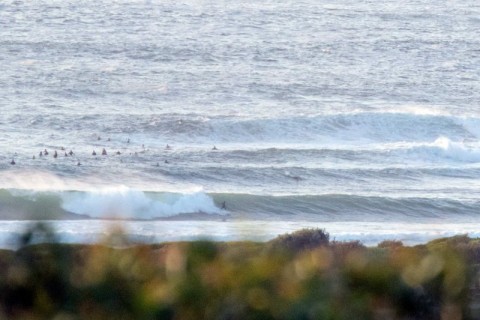
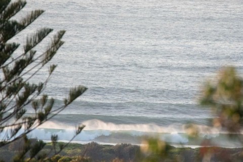
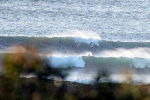
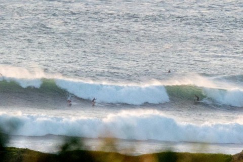
It came up strongly yesterday afternoon and this morning the energy intensity has increased another notch. The latest MHL data was showing 13-second 3 metre SE swell dominating, but there’s also a fair amount of long period NE in the mix. Dee Why looked to be right on the edge of maxing out on the sets. The bombs will take it over the top I’d say.
Wind was light SW early but is due to turn east to SE later but with luck it won’t go too hard. Swell is set to stay at around the current intensity for another day or so, with tomorrow seeing NE wind.
Tide is dropping to low at 1235.
My plan is to be out and about as much as possible, so expect an update or two in due course!
If you’re thinking of getting in, spend some time watching before you commit. The next day or two will not be suitable for beginners because it’ll be so easy for the inexperienced to get into strife.
Weather Situation
A high pressure ridge extends from a high pressure system centred in the Bight to the state’s east, with moderate to fresh southerly winds gradually easing and shifting more northerly on the northern half of the coast today. A light north to northeasterly airstream will extend to most of the coast on Friday, as a high pressure centre builds over the western Tasman Sea. A low pressure trough is likely to develop over the northeast by the weekend with winds freshening and turning southerly again on the southern half of the coast.
Forecast for Thursday until midnight
Winds
Southerly 10 to 15 knots turning east to southeasterly below 10 knots in the afternoon then becoming east to northeasterly in the late evening.
Seas
Around 1 metre.
1st Swell
Southerly 2.5 to 3 metres.
2nd Swell
Easterly around 1 metre.
Weather
Partly cloudy. 20% chance of a shower offshore, near zero chance elsewhere.
Caution
Large and powerful surf conditions are expected to be hazardous for coastal activities such as crossing bars by boat and rock fishing.
Friday 19 February
Winds
Northeasterly about 10 knots increasing to 15 to 20 knots before dawn.
Seas
Around 1 metre, increasing to 1 to 1.5 metres during the morning.
1st Swell
Southerly 2 to 2.5 metres, decreasing to 1.5 metres around midday.
2nd Swell
Easterly around 1 metre.
Weather
Partly cloudy. 20% chance of a shower offshore at night. Near zero chance of rain elsewhere.
Caution
Large and powerful surf conditions in the early morning are expected to be hazardous for coastal activities such as crossing bars by boat and rock fishing.
Saturday 20 February
Winds
North to northeasterly 15 to 20 knots shifting southerly 15 to 25 knots during the morning.
Seas
1 to 1.5 metres, increasing to 1 to 2 metres during the morning.
1st Swell
Southerly 1 to 1.5 metres, tending southeasterly 1 to 1.5 metres during the evening.
2nd Swell
Easterly around 1 metre, increasing to 1 to 1.5 metres offshore.
Weather
Partly cloudy. 60% chance of showers. The chance of a thunderstorm.


