Hello Friends,
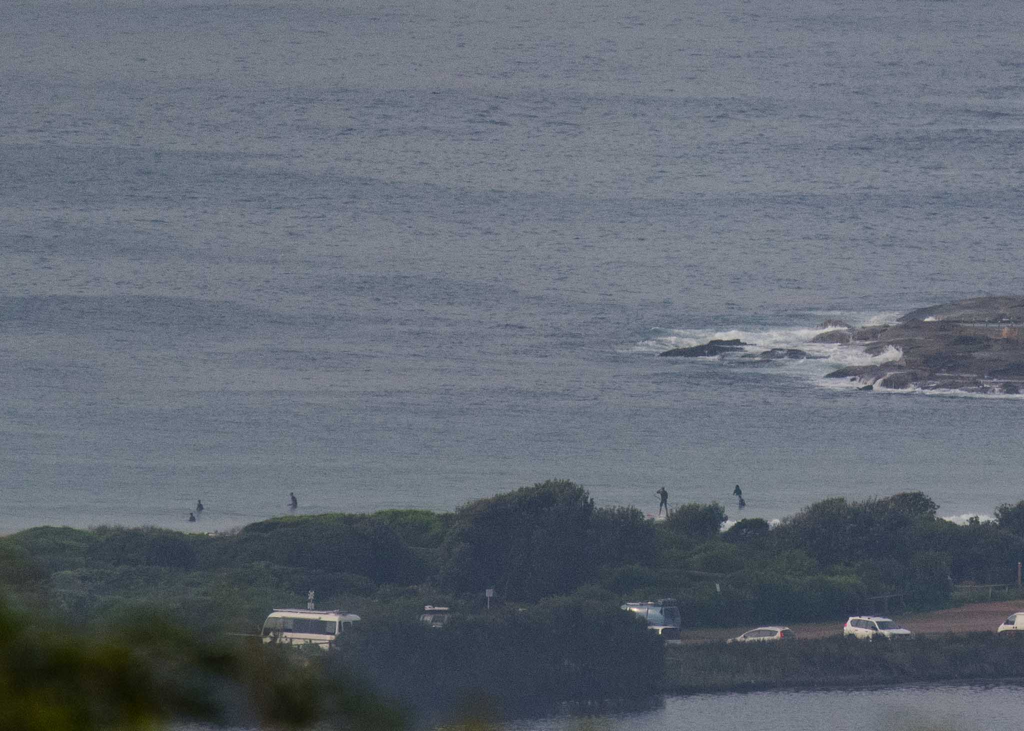
Thick fog early. I’ll add pics once it lifts.
Wind was a westerly at 8 kts as of 0720. An hour earlier the MHL buoy was showing less than a metre of east swell at 8 seconds. Tide was a deep 1.7 m high at 0515 and is now dropping to 0.4 m at 1145.
Going by the numbers you’d have to say it’s going to be very small again today, but probably not utterly flat at the magnets. Expect ankle to knee with the odd waist high bomb at the most energetic spots.
The smooth conditions won’t last long though. We’re due to enter southerly world toward midday. Looking at the models I’m not real hopeful about the surf prospects as the predicted periods are in the 6-8 second range, so not much is likely to get into the protected south corners. But we’ll see what the Goat thinks when he posts his latest ruminations later today.
Check back for the pics later, and have yourself a fun Thursday!

Weather Situation
A vigorous southerly change associated with a cold front crossing the southern Tasman Sea is moving along the New South Wales far south coat and is expected to reach Sydney Waters on Thursday afternoon and the far north coast in the evening. Southerly winds will gradually ease during Friday and Saturday and tend south to southeasterly as a high pressure system south of the Bight moves very slowly east extending a ridge along the coast.
Forecast for Thursday until midnight
Strong Wind Warning for Thursday for Sydney Coast
- Winds
- West to southwesterly 10 to 15 knots turning southerly 20 to 25 knots in the late morning and early afternoon. Winds reaching up to 30 knots during the afternoon and evening.
- Seas
- Below 1 metre, increasing to 1 to 2 metres around midday, then increasing to 2 to 3 metres during the afternoon.
- 1st Swell
- Easterly around 1 metre inshore, increasing to 1 to 1.5 metres offshore.
- 2nd Swell
- Southerly around 1 metre.
- Weather
- Partly cloudy. The chance of a thunderstorm offshore during this afternoon and evening.
Friday 27 April
Strong Wind Warning for Friday for Sydney Coast
- Winds
- Southerly 15 to 25 knots, reaching up to 30 knots during the morning.
- Seas
- 2 to 3 metres, decreasing to 1.5 to 2 metres around midday.
- 1st Swell
- Southerly 1 to 1.5 metres.
- 2nd Swell
- Easterly around 1 metre.
- Weather
- Partly cloudy. 60% chance of showers.
Saturday 28 April
- Winds
- South to southeasterly 15 to 20 knots.
- Seas
- 1 to 1.5 metres.
- 1st Swell
- South to southeasterly 1 to 1.5 metres.
- 2nd Swell
- Easterly around 1 metre.
- Weather
- Partly cloudy. 80% chance of showers.


