Tiny lines

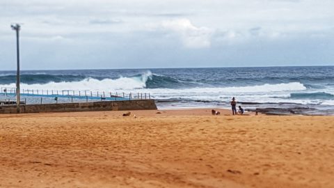
Out for a ride and can report there is more energy than this morning. Best waves were at Northy but there were close to 20 in the water chasing the very occasional sets. Biggest waves were around the chest high range maybe a touch bigger. Looked a bit sectiony too. At Dee Why there were […]
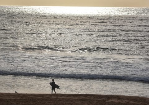
Northy firing at dusk
Out for a ride and discovered Northy is clean and head to head plus with an unusually light crowd.
Not amazing at Northy
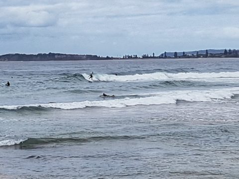
Inconsistent and surprisingly weak looking at North Narrabeen where a small crowd is hanging around waiting for the odd shoulder high wave face to turn up. Rides were short and you had to work to stay in the section.
Northy better than Dee Why

30 plus in the water at Northy where there are actually little catchable waves every now and then. Competition looks fierce for the soft and slow waist high sets. Heaps of families strolling past as I watch. Cooling the kids off ahead of the heat. Summer time. Not sure if I’ll have a report for […]
Sunny and hot Collaroy-Narrabeen
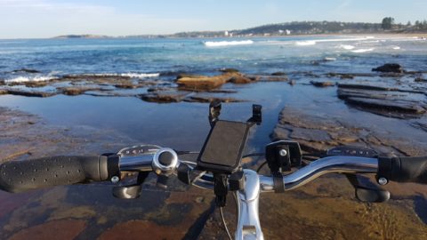
Hello Friends Out and about without my proper camera so using the phone and binocs rig. Already warm at 0800 and waves are tiny. Collaroy-Narrabeen looks to be knee to maybe waist on the biggest ones. Wind is light for now.
Late morning Nth Narra
Next stops at little Narra and Northy. Same size as Mona and Warriewood but breaking closer to shore and therefore a bit snappier. But rides just as brief.
Northy late morning
Out for a bike ride so dropped by Northy for a look. It’s setty and pretty soft and slow looking but faces on the bombs are head high (occasionally). Surface as of 1030 still smooth and crowd was under the 20 mark.
Northy Sat arvo
20 people at the alley getting surprisingly fun looking chest high rights and lefts.
Pictures from Northy this arvo
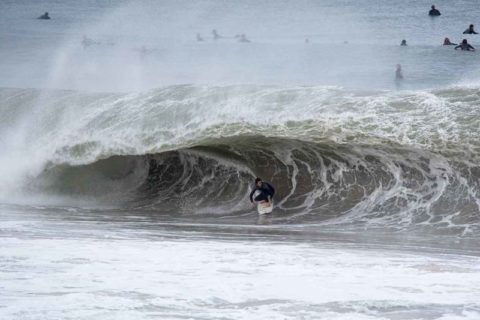
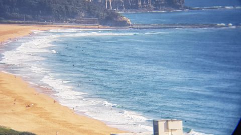
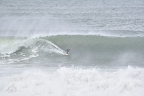
Hello late evening visitors… Struggling with a steampowered internet connection atm, so anyway, herewith a few snaps from this afternoon mainly at North Narrabeen but also down near Gardens. Northy was as good as I think I’ve ever seen it. Very heavy, very makeable and unbelievably consistent. I mostly shot video (lots to edit now), […]
A wave at Northy
Light rain falling when I pulled up at Northy for a look. Very clean conditions and you could paddle into the medium size ones – unlike at Gardens. Might stick around a bit to see if I can get any more pics and maybe some vid