Pics: North Narrabeen at noon, Thursday

Had a few spare minutes and so I stopped by Northy and grabbed about 80 snaps of people making the most of the weak, small and messy conditions. Even so, it was way better than I’d expected to see given how direly tiny it was at Dee Why this morning. Clicking on a pic will […]
Tiny town
Hello Friends, The puniness continues this morning. Swell is showing out of the east at about a metre at sea, but with a choppy 7 second period. If you were up early to beat the wind, you could find the odd knee to waist high bump at most of Sydney’s beaches (well, not the south […]
Mostly marginal but not flat
Hello Friends, Just a tiny trickle of knee to waist high bumps for the early risers this morning. Tide was low at 0625 and will hit high around 1300, so the plan is to get in asap I’d say. Outlook across the next week is for more of this kind of thing […]
Sunny skies and very tiny waves
Hello Friends, Not much of anything on offer ahead of what is expected to be a windy day. Swell is out of the SSE at maybe half a metre and 7 seconds apart. There is some 11 second stuff in there and while nothing was evident along the Dee Why to Longy stretch, […]
Waves about this morning
Hello Friends, Still a couple metres of more easterly swell around this morning. Sets at exposed spots are shoulder high plus. At Dee Why that meant bigger and more consistent in the beachy than at the point. Around at Collaroy-Narra stretch, the southern extent had its share of picturesque looking shutdowns […]
Still tiny but a hint of improvement… maybe…
Hello Friends, Swell has perked ever so slightly this morning. But it’s out of the south at only about a metre, so you’ll do well to pick up something in the waist high range at exposed spots. Looked to be a long wait for really fairly feeble waves. There were only three people in the […]
PICS: Friday late morning, North Narrabeen
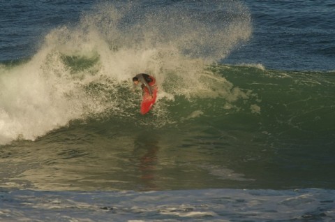
Friday the 29th of June saw a couple metres of 9-10 sec period east swell rolling into Sydney’s beaches. I took an hour out to shoot the action at North Narrabeen from about 1110 to 1210. At that stage there were a few tasty rights coming in at Carparks as well as the standard high […]
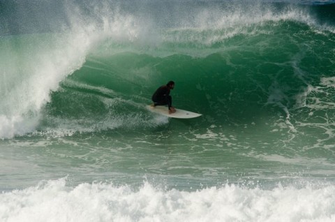
PICS by Don: North Narrabeen, Thr afternoon 14 June 2012
As the daylight drained away on Thursday, I made another trek to the bearpit known as North Narrabeen. The east swell was still in full cry and the afternoon crew were all over it… See all the pictures in this gallery See all the pictures in this gallery
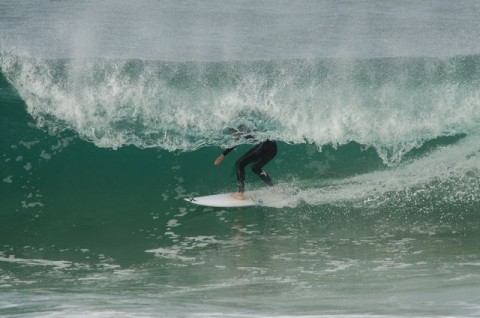
PICS by Don: North Narrabeen, Thr. morning session
Very solid and clean east swell lit up Narrabeen all day on Thursday. And I shot from about 1000 to 1100… before coming back again late in the afternoon for a few more… Check out the entire gallery of pictures here. Check out the entire gallery of pictures here.
The east energy continues but down a touch
Hello Friends, Out and about this morning and it looks as though the swell has backed off a touch but it ain’t tiny. Swell is still out of the east. It’s about 2 metres on average at sea with an average period of 11 seconds. That means overhead sets at exposed […]