Pumping point at 0630
Hello Friends, Light wind and surprisingly smooth as the day got started. More importantly though, the swell cleaned up a lot overnight and it was still pretty big. Wave faces on the bombs at Dee Why point were into the 2x overhead range. Definitely not a morning for beginners, or even a fair percentage of […]
Sunday looks like an absolute corker
Hello Friends, What a morning! Clear skies, light offshore breeze for the early session and above all heaps of fun shoulder to head high energy SSE swell. At 0700 it was 3 metres and coming from 158 degrees at 10 seconds apart. Tide was high at 0820 Here’s the Bureau’s call: Forecast for Sunday until […]
Clean and solid start

Hello Friends, Swell was 2.5 metres at 14 seconds apart from the south to SE and wind was lightly offshore under mostly clear skies at 0645. Set wave faces at the point were 1.5x overhead for the already healthy crowd. Consistency seemed to be pretty good too. Sets along the beach were a similar size […]
Thursday morning firing up
Hello Friends, Short version: at 0700 there were heaps of waves at Dee Why with solidly overhead sets being pretty common. Quality wasn’t too bad either thanks to light west breezes and a low tide at 0845. The MHL buoy was showing 4.5 metres of 13-14 sec S-SSE swell as of 0400. Swell is expected […]
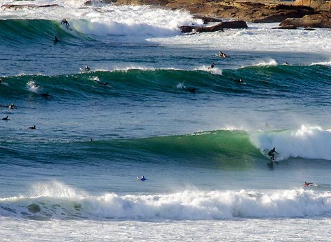
Swell arrived, hope you got some
Hello Friends, Looked as though everyone was in the water today. I don’t think I’ve seen so many spots so crowded in a very long time. The morning started nearly flat, but by 1100 or so all the south magnet spots were firing up big time. The wind got pretty strong in the middle part […]
Hello Friends, Can you get to the beach? Looks like it’d be a plan if you can. Dee Why was busy with the holiday crowds, but there were lefts along the beach (and the odd right) along with a fairly steady supply for the crew at the point. Size ranges from chest to head plus […]
Briefly sunny and pumping this morning
Hello Friends, Brilliant looking conditions as Monday got started. Definitely for the fit and experienced only out at the point. Wave faces were anywhere from head high to double, maybe double plus on the bombs. Swell is out of the SE at 11 seconds apart with a height at sea of 3 metres (up to […]
It’s still pumping people
Hello Friends, For close to two weeks it was looking like today might be the goods, and lo and behold, so it is. Swell is much cleaner this morning than 24 hours ago and it looks to be just about the same size, but maybe a touch smaller on the biggest ones. That said, when […]
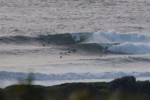
Pumping Friday morning at Dee Why
Hello Friends, Get out there if you can. It was going off this morning as all the elements came together: light wind, 2 metres of 11 sec SE swell and sunny skies to make it all pretty like. Extremely crowded for some odd reason, so you might want to take that into account. But on […]
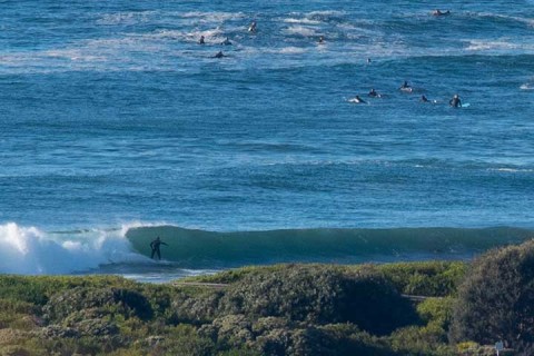
Pumping southeast swell
Hello Friends, Close to 3 metres of 11 second SE swell rolling in with light offshores and sunny skies as Saturday got started. Wind is set to be light until this evening when it will get up to 10-15kts from the SE. Next tide is a big high at 1120, followed by a low at […]