Waist high at Dee Why
Hello Friends, Still a few small waves about this morning at the point and along the beach. It was ranging from knee to waist and a bit at 0730. Wind was lightly offshore but is expected to wander around to the SE before settling to the NE at 10-15 kts this afternoon. Tide will be […]
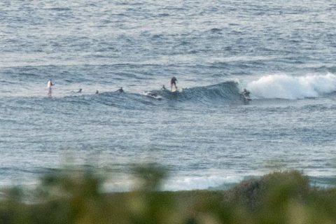
Another morning with a few cute little waves

Hello Friends, Fun but fairly fat little waist to chest plus sets showing up at spots that take east swell as the morning gets going. There were folks scattered along the beach at Dee Why and from about Marquesas north along the Collaroy-Narrabeen stretch. Surface conditions were glassy around 080, but by the time we […]
Cross Dee Why off the list
Hello Friends, Light WSW breezes to kick off Tuesday along the beaches of Sydney. Swell is same-old, same-old – ie, it’s out of the east, averaging around 1.5 metres at sea and packing a less than impressive 8 second period. This was delivering knee to waist high little weak things along the beach and out […]
A few lumpy ones about
Update: Went down to Dee Why for the Australia Day breakfast with my daughter and her friend. Surprisingly large number of folk enjoying the cheap eats and various things to see, do and listen to on a morning threatening with rain. Lots of folks in the water at Dee Why, but conditions were mainly slow, […]
Another messy and small morning, but at least it’s sunny
Hello Friends, Generally junky and weak looking this morning. We have a steady NE seabreeze and some messy 1.5 metre easterly wind swell. The NE’r will be picking up as the day goes along and by this afternoon you can expect a standard issue summer NE onshore of 15-20 kts. On the bright side, well, […]
Happy for Christmas?
Hello Friends, Wind was light and out of the north for early risers as a small east wind swell made its slight presence felt. Meanwhile, up the coast the energy levels are ramping up and the promise of sizable swell for Boxing Day in Sydney looks good from my vantage point on the other side […]
Sunny morning and little waves about in Sydney
Hello Friends, Good to see some sunshine this morning along with a more easterly swell direction. Again, it’s not big, but some peaks are getting into the chest high range at optimally exposed locations. I had to wait around to grab the snaps, so expect to have a bit of a chat between the little […]
Hello Friends, Light s to se wind mid-morning, but it’s supposed to swing NE later. Swell is out of the east at around the 1.5 metre mark but with a less than amazing average period of about 8 seconds. I reckon you might get the odd chest high one at exposed spots, but that mostly […]
Pics: North Narrabeen, Thr morning nice!
North Narrabeen turned on some very clean and often punchy sets on Thursday morning. The crew was on it, so I took pictures before I couldn’t stand it any more and joined them! While it was nearly flat along many of Sydney’s beaches, spots that liked the little east swell on Thursday definitely had their […]
Not quite flat… but pretty close
Hello Friends, Grey skies to start – again. Surf conditions are distinctly marginal. In fact, we’re getting closer to flatness. The MHL data is showing 1.5 metres of 8 sec period east windswell, so there could be the odd waist high set at the exposed locations. Wind is supposed to swing around to the […]