Waves to be had
Hello Friends, Only one person in the water at the point as of 0730 and yet, as the pictures show, there were definitely chest plus waves to be had. Couldn’t see much up the beach, but there should be the odd option around the Pole. Water’s pretty likely to be woofy though. Wind was light […]
Rainy morning, rainy day?

Hello Friends, The RealSurf wheelhouse is socked in as the rain tumbles down outside and the weather radar glows with more incoming. The MHL buoy is showing 2 metres of 8-second period east swell and the Bureau’s call is for the swell to push up into the 2.5-3 metre range later today. Wind is currently […]
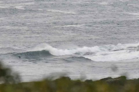
Monday surf
Hello Friends, Apart from the mainly cloudy skies, conditions were fun looking at Dee Why point thanks to a couple of metres of mainly east swell with an average period of about 8 seconds. Tide was low at 0520 and will be back to high at 1125. Wind is lightly offshore early but is set […]
Waves about for the early
Hello Friends, More showers coming through this morning but skies are set to clear later and wind will pick up and come around to the NE to E. Swell this morning is mainly out of the east at about 8 seconds apart. It’s a couple metres out at sea and that’s translating into waist to […]
Whadya know, little waves around the place
Hello Friends, Usual late Sunday start for your correspondent. The steady onshores continued this morning, but all things considered, they weren’t beating it up to badly for the early. And, the easterly wind swell is now averaging close to two metres with an average period of 8 seconds. While Northy is off limits due to […]
Hello Friends Looks like another day of onshores and showery weather for Sydney today. Swell’s into the two metre range, but those easterlies will mean conditions are going to be dire. And Huey’s got the onshores lined up for tomorrow as well. Not a good look. Here’s the latest from those who know… Weather Situation […]
Holding pattern time
Hello Friends, According to the data from MHL’s Sydney buoy, we have about two metres of east swell at about 8 seconds coming in to our beaches. There isn’t enough energy to have attracted any takers at Dee Why, but then it’s not the first place you’d look for a wave in easterly conditions either. […]
Messy but not flat
Hello Friends, Rained pretty heavily at RealSurf HQ last night. How’d it go in your part of the world? Was hoping for a bit better result this morning, but ocean still looks pretty lumpy and flabby still. There’s not much wind about as I write this on short and final to 0800, and what there […]
Late arvo update
Hello Friends, Climbed aloft to the crow’s nest for one last view of the beach on this winter solstice day. It got steadily gloomier this afternoon, so the light levels were getting pretty low for taking pictures. I dialled up the sensitivity to ISO 800 and decreased the shutter speed to a barely adequate 1/200 […]
Sorta pearly kinda light this morning
Hello Friends, Stumbled through the wheelhouse door late this morning, as is my wont on a Sunday. Climbed aloft for a quick look at the unfolding day. Small crowd is hanging around at the southern end of the Dee Why longy stretch. A few are over at the point. Conditions are sorta lumpy and disorganised […]