Quiet start to Tuesday
Hello Friends, Fair amount of high cloud across the sky as Tuesday kicked off in Sydney. Along the beaches, wind was around 10 kts from the NW. Swell was coming from the SE at a metre but it was just 6 seconds apart, so I’d say the micro conditions at Dee Why will be replicated […]
Southerly’s blown up some waves

Hello Friends, Interesting. There are shoulder plus sets at Dee Why thanks to the stiff southerly, but the MHL buoy is reporting only a metre on average at 6 seconds. The seas are up toward the 3 metre mark, so I’d say the folks in the water are catching lumped up seas as much as […]
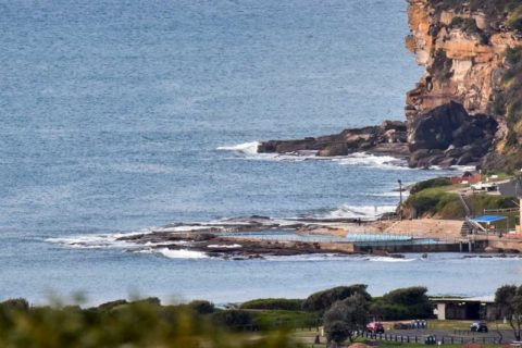
Dee Why looked flat to me this morning
Hello Friends, The forecast calls for a shower or two clearing this afternoon, but there wasn’t a cloud in the sky at 0700. Nor, sadly was there a wave on the beach at Dee Why. Swell seems to have faded away to nothing – as the forecast said it would. Looks like a day for […]
Flat old Saturday morning
Hello Friends, No sign of a surfable bump at the Dee Why end of the beach when I checked around 0700. Tide and wind were both favourable but Huey was only sending in about a metre of south wind swell (average period was 6 seconds). No one was in the water (hardly a surprise). Outlook […]
Puny morning at Dee Why
Hello Friends, Well, back from the Surfrider conference in Margaret River to dear old Sydney and things seem to be much as I left them on Friday – namely weak and tiny. The MHL buoy is showing a metre of 6sec period south swell out at sea. In on the beach at Dee Why […]
Are you super keen?
Hello Friends, Lookin’ pretty small, but not utterly and absolutely flat at Dee Why beach as the Wednesday opened. The morning light had a funny slightly dusty look to it too. Sets at the few functioning low tide peaks were hitting the waist high mark. A cold and stiff westerly was encouraging the keeping of […]
We’re waiting… in your own time Huey…
Afternoon update: Well, the models were right… I couldn’t see it this morning, but a pulse did fill in (along with an onshore, sadly) and when I went by Curly mid-arvo there were a few okay size sets. However, the onshore was making it quite junky, there were long waits for catchable ones, and they […]
Beautiful morning, shame about the surf
Hello Friends, Microscopic again this morning where Dee Why’s concerned, and given the swell settings (a metre from the south at 6 seconds), you’d have to guess the story is the same all across our region. But it’s a beautiful morning out there, so that has to be a good thing. With no surf prospects […]
Still micro folks
Hello Friends, Election eve and it’s micro. Worse, the models continue to call for minor to flat conditions for the next week – at least. Has spring sprung on us a little early? There are still big low pressure systems in the southern ocean but they’re being resolutely bounced away from us by the persistent […]
Another quiet one
Hello Friends Seems as that we have another day of microness in Sydney. The MHL buoy is showing about a metre from the south at around 6 seconds apart – much the same as it’s been for the last few days. So another day of nothing much in the way of wave options. […]