Tiny Tuesday at Dee Why
Hello Friends, You’ll be doing very well to find anything into the surfable range this morning at Dee Why. It’s looking ankle to knee at the point and along the beach and the MHL buoy is showing a metre of 7 sec south bump. Not that it matters much, but tide’s dropping to the low […]
Yay! Little beachies this morning
Hello Friends, Beautiful, breezily offshore start to Sunday at Dee Why – and there were fun looking little knee to waist high sets when I checked at 0830 on the dropping tide (low’s at 1040). Quite a few folk in the water along the bit of the beach I can see from the crows nest. […]
Take the longest board you have and hope for something
Hello Friends, Another beautiful morning in Sydney, but you’ll be struggling to find a wave over knee high at Dee Why beach (the point’s a write-off). And I’d be surprised if anywhere else was much different. There’s about a metre of 7-sec south wind swell dribbling in as we approach the low tide at 0945. […]
Just about flat at the point this morning
Hello Friends, Swell’s ratcheted down another notch and as of 0600 it was about a metre from the dead south at pretty gutless 7 seconds. Skies were clouding over in preparation for the 90% chance of rain today. Tide’s heading to the low at 0945. Wind was offshore but should be SW later. Swell’s supposed […]
Sunny and surfless Sunday

Hello Friends, Yesterday morning I was getting a little hopeful about this morning’s prospects. Alas, the swell has moved around to the south but it hasn’t picked up at all. It’s showing about a metre as of 0700, but the average period is only about 7 seconds. Buoy data from south of Sydney is showing […]
Yeah, still flat, sorry…
Hello Friends, Sunny, light westerly breezes, warm feel to the day and nothing, absolutely nada, on the surf front. Wish I had better news for you, but there it is. And this morning’s swell models aren’t showing us much of anything to get excited about on the east coast. Looks pretty intense down in Vicco […]
So beautiful, so flat
Hello Friends, Sydney surfers will need every gram of keen-ness they can muster today. Really, being realistic, you could go for a long paddle 10 metres off the beach without getting your hair wet at most places today. It’s that small. According to the MHL buoy data, the swell is coming from the […]
Surf? What’s that?
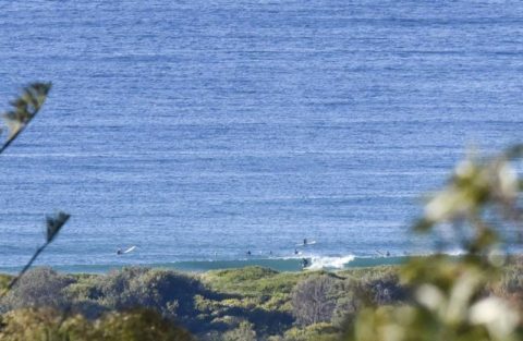
UPDATE: Had to drive to Manly, so checked it out on the way back to Dee Why and it seems the swell has perked a bit. A scrappy but rideable little south was showing at Curly and to a lesser extent at Manly. So the gloom of my original report below may have been premature. […]
Waiting on you Huey
Hello Friends, Well, as expected, Sunday kicked off bright and sunny with a cool offshore breeze but only the tiniest of little south wind swells coming in. According to the MHL data, it was about a metre on average with a typical period of maybe 7 seconds. There is some 10 second stuff in the […]
Clouds vs sky: sky winning early
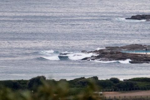
Hello Friends, There’s a turn-up for the books; no onshores and mostly clear skies. There is one ingredient I’d have liked to have seen more of though. As my piccie from this morning reveals, we have only the tiniest of tiny lines coming in. If you’ve got a SUP or a mal, you’re equipped. Sets […]