
Hello Friends,
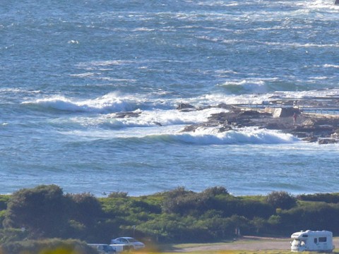
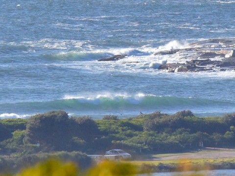
Wind was out of the NNE from the get-go this morning. As of 0745 it was 15-20 kts and Dee Why was looking pretty chopped up. The point seemed to be out of action but there were a few little scrappy things along the beach – not that there were many takers at all. Unfortunately there’s a strong wind warning today for NE’rs into the 25-30 kts.
Swell was still coming from the east at 10 seconds apart with an average height at sea of 1.5 metres. That should translate into shoulder plus sets at the biggest spots. Next tide is a low at 1030.
The strong wind warning has been hoisted for tomorrow as well. Tonight the wind is expected to go north before swinging to the south early and coming up into the 25-30 kt range. As Wednesday goes along the wind is predicted to swing SE. Not a great outlook, sadly.
Thursday should be back to east to NE wind with a smallish easterly wind swell, so probably not too fab. Friday currently looks faintly hopeful though. The Bureau says mostly sunny with west to SW wind overnight – but around first light it could switch pretty strongly to the S-SE. Here’s hoping that schedule slips a little so the dawn patrol can grab a little something before it goes pear-shaped.
Have yourself a top old Tuesday everyone!
A high lies over the southern Tasman Sea while a trough lies over western NSW and a cold front crosses waters south of the Bight. The trough is expected to deepen today with northerly winds strengthening along much of the coast. The cold front and associated strong to gale force southwest to southerly change will reach the south coast this evening, then move north tomorrow and gradually weaken. Behind this, a weak high is forecast to bring a brief return to northerly winds in most areas on Thursday, before the next trough and southerly change on Friday.
Forecast for Tuesday until midnight
Strong Wind Warning for Tuesday for Sydney Coast
- Winds
- North to northeasterly 15 to 20 knots, increasing to 25 to 30 knots during the afternoon.
- Seas
- 1.5 to 2 metres, increasing to 2.5 to 3 metres around midday.
- Swell
- Easterly around 1 metre, increasing to 1 to 1.5 metres by early evening.
- Weather
- Partly cloudy. 40% chance of showers during the morning and afternoon. The chance of a thunderstorm during this afternoon and early evening.
Wednesday 17 December
Strong Wind Warning for Wednesday for Sydney Coast
- Winds
- North to northwesterly 15 to 20 knots shifting southerly 25 to 30 knots early in the morning then tending southeasterly 15 to 20 knots in the early afternoon.
- Seas
- 1.5 to 2.5 metres.
- Swell
- Easterly 1 to 1.5 metres, decreasing to around 1 metre during the morning, then increasing to 1 to 1.5 metres around midday.
- Weather
- Mostly sunny.
Thursday 18 December
- Winds
- East to northeasterly 10 to 15 knots turning north to northwesterly 15 to 20 knots during the evening.
- Seas
- Below 1 metre, increasing to 1 to 1.5 metres during the morning.
- Swell
- Easterly 1 to 1.5 metres.
- Weather
- Partly cloudy. 40% chance of showers. The chance of a thunderstorm.

