
Hello Friends,
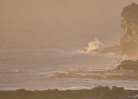
Had hoped for something a bit more interesting I have to say. Still, there is some junky stuff around if you’re really keen. It’s around the 8 second mark and coming mainly from the NE. Out at sea the heights are about 1.5 metres, but you probably won’t see too many wave faces into that range for the early.
The Bureau says the swell should bump up a notch to coincide with an incoming tide after 0940. Wind’s set to be north most of the day, but there could be a swing to the SW for the late arvo sesh. Combine a dropping tide, NE windswell and south wind and there might be some fun before dark.
Outlook is for SE wind tomorrow with the E-NE windswell hanging on. Friday should see the SE fade out to be replaced by standard issue NE. Good news is that the Bureau and the models are pointing toward a 10-sec south pulse in the shoulder to head high range for Friday.
Have yourself a top old Wednesday one and all!
Weather Situation
A high pressure system near New Zealand is moving southeast, maintaining a ridge towards the New South Wales coast. A low west of Bass Strait and an associated trough of low pressure extending through the west of New South Wales are moving east, and will bring a west to southwesterly change to the coast during today. A ridge of high pressure should then move over the state as the low slips away to the southeast, maintaining a southwest to southeasterly airstream on Thursday. Winds should tend back to the northeast on Friday ahead of another southerly change expected to reach the far south coast at night.
Forecast for Wednesday until midnight
Strong Wind Warning for Wednesday for Sydney Coast
- Winds
- Northerly 15 to 25 knots, reaching up to 30 knots offshore in the morning. Winds shifting southwesterly in the afternoon and evening.
- Seas
- 2 to 3 metres, decreasing below 2 metres around midday, then decreasing to 1 to 1.5 metres during the afternoon.
- Swell
- Easterly 1 to 1.5 metres, increasing to 1.5 to 2 metres during the morning, then tending northeasterly 1.5 to 2 metres around midday.
- Weather
- 50% chance of showers this morning. The chance of a thunderstorm offshore this morning. Mostly sunny afternoon.
Thursday 15 January
- Winds
- West to southwesterly 15 to 20 knots shifting southeasterly 10 to 15 knots during the morning.
- Seas
- 1 to 1.5 metres.
- Swell
- East to northeasterly 1 to 1.5 metres, increasing to 1 to 2 metres offshore.
- Weather
- Cloudy. 50% chance of showers.
Friday 16 January
- Winds
- East to southeasterly below 10 knots becoming north to northeasterly during the morning then increasing to 15 to 20 knots during the day.
- Seas
- Below 1 metre, increasing to 1 to 2 metres during the afternoon.
- Swell
- Southerly 1 to 1.5 metres, increasing to 1.5 to 2 metres offshore.
- Weather
- Partly cloudy. 40% chance of showers.

