
Hello Friends,
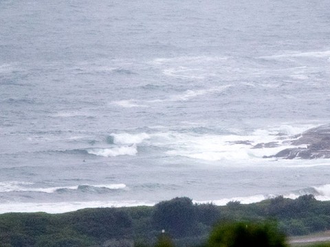
At 0830 while waiting for the rain to let up enough to get a picture or two, North Head was reporting 10-15 kts of ESE wind and the nearest active MHL buoy down at Pt Kembla was picking up 2 metres of south swell. Unfortunately it was showing the average period at about 6 seconds. So, I wouldn’t be expecting to find anything much in the way of quality. But worse than that, yesterday the Warriewood treatment plant was discharging partially treated sewage and this morning Beachwatch was warning that pollution is likely at pretty much all of Sydney’s beaches thanks to 92mm of rain in the last 24 hours. And it’s still raining steadily as I write this.
The Bureau tells us that the swell will build today and get into the 2-3 metre range. They predict that it will then stay around that size through Saturday. While the wind is expected to be unhelpful today, from tomorrow it should get more SW and by Friday the swell should be building up into the 2.5-4 metre range from the S to SE. If the swell models have it right, the energy should stick around through Sunday. The more optimistic projections reckon swell could be well and truly in the surfable range right into the middle of next week.
Now, if we could just get some sunshine to kill off the pathogens currently washing into the ocean from our streets…
Have yourself a good Wednesday and keep an eye on Friday…
Weather Situation
A broad low pressure trough lies across the eastern Tasman Sea while a high pressure system moves towards Tasmania extending a ridge along the New South Wales coast. During Tuesday and Wednesday the trough will move closer to the coast and a low is expected to develop within it on Thursday bringing strong southwest to southeasterly winds along the south and central coasts on Thursday with gale force winds possible on Friday. This low pressure system will begin to weaken and move east away from New South Wales during the course of the weekend.
Forecast for Wednesday until midnight
Strong Wind Warning for Wednesday for Sydney Coast
- Winds
- Southeasterly 15 to 25 knots tending southerly 20 to 30 knots in the morning.
- Seas
- 2 to 3 metres.
- Swell
- Easterly 1.5 metres, increasing to 2 to 2.5 metres during the morning, then tending southeasterly 2.5 to 3 metres during the afternoon.
- Weather
- Cloudy. 80% chance of showers.
Thursday 29 January
Strong Wind Warning for Thursday for Sydney Coast
- Winds
- Southerly 20 to 30 knots turning southwesterly in the morning.
- Seas
- 2.5 to 3 metres.
- Swell
- Southeasterly 2 to 3 metres.
- Weather
- Partly cloudy. 70% chance of showers.
Friday 30 January
- Winds
- Southwesterly 20 to 30 knots tending south to southwesterly 15 to 20 knots during the day then becoming variable about 10 knots during the evening.
- Seas
- 2 to 3 metres, decreasing to 1 to 1.5 metres during the afternoon.
- Swell
- South to southeasterly 2.5 to 3 metres, increasing to 2.5 to 4 metres offshore.
- Weather
- Partly cloudy. 60% chance of showers.


