
Hello Friends,
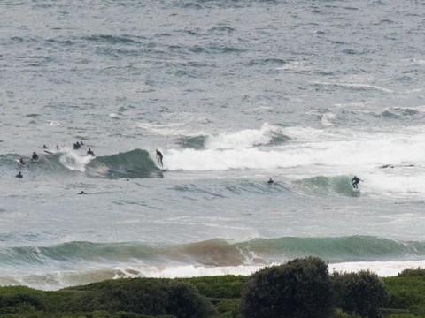
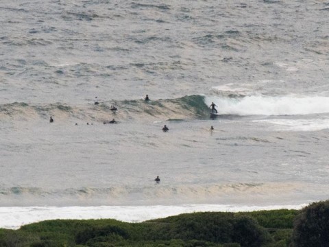
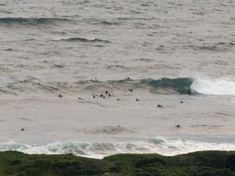
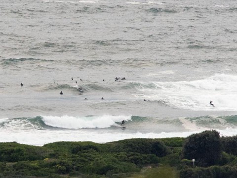
Swell started to kick in just after dark yesterday and as of 0600 this morning the MHL buoy off Sydney was picking up 4.2 metres of 13-second period south swell. Wind was WSW at around 10-12 kts. Tide’s coming into the high at 1040.
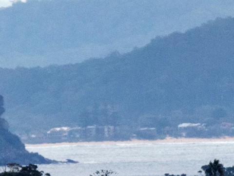
As the pictures show, there is some size but the swell has a raggedy, raw look so the quality isn’t all that impressive. Wave faces are in the head high plus range on the sets at both the point and along the beach. I’d expect more exposed spots to be consistently bigger.
From the shape of the pulse down at Eden, it looks as though the Bureau’s call for a peak today and then a gradual decrease back to smallish (but not flat) on Saturday. Wind looks like being brisk for the next couple of days, so I’m not expecting conditions to clean up appreciably. If anything tomorrow could see it even choppier because it’ll be blowing from the south. Saturday may be better because although the swell will be fading, the wind’s expected to be getting lighter as the day goes along.
It’ll be interesting to see what the Goat thinks about the coming week. I have to say I’m pretty encouraged by what some of the models are projecting right now…
I’ll be out and about, so check back later for more piccies… and have yourself a great day!
Weather Situation
Vigorous south to southwesterly winds along the south and central coast will gradually ease during the day as a deep low pressure system off the New South Wales far south coast moves further east and a strong high pressure system south of Bight extends a ridge to the western Tasman Sea behind the low.
Forecast for Thursday until midnight
Gale Warning for Thursday for Sydney Coast
Winds
Southwesterly 25 to 30 knots, reaching up to 35 knots offshore in the morning. Winds turning southerly in the evening.
Seas
2 to 3 metres, increasing to 3 to 4 metres offshore.
Swell
Southerly 2.5 to 3 metres, increasing to 3 to 4 metres offshore.
Weather
Cloudy. 60% chance of showers offshore, 30% chance elsewhere.
Caution
Large and powerful surf conditions are expected to be hazardous for coastal activities such as crossing bars by boat and rock fishing.
Friday 10 April
Strong Wind Warning for Friday for Sydney Coast
Winds
Southerly 15 to 25 knots, reaching up to 30 knots early in the morning. Winds decreasing to about 10 knots in the late evening.
Seas
2 to 3 metres, decreasing to 1 to 1.5 metres in the afternoon, then decreasing to 1 metre by early evening.
Swell
Southerly 3 metres, tending southeasterly 2 to 3 metres during the morning, then decreasing to 2 metres later in the evening.
Weather
Partly cloudy. 50% chance of showers.
Caution
Large and powerful surf conditions in the early morning are expected to be hazardous for coastal activities such as crossing bars by boat and rock fishing.
Saturday 11 April
Winds
Southerly 10 to 15 knots becoming variable below 10 knots during the day.
Seas
Below 1 metre.
Swell
Southeasterly 2 metres, decreasing to 1.5 metres during the morning.
Weather
Partly cloudy. 40% chance of showers.


