
Hello Friends,
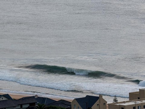
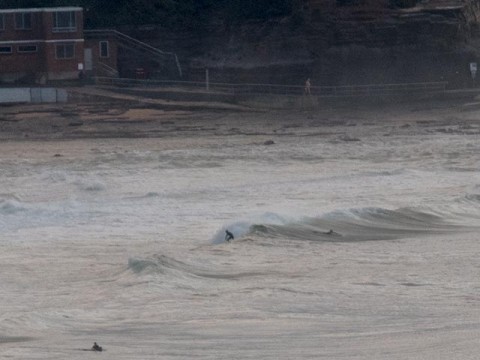
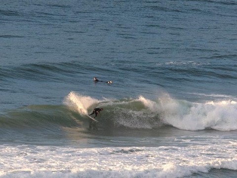
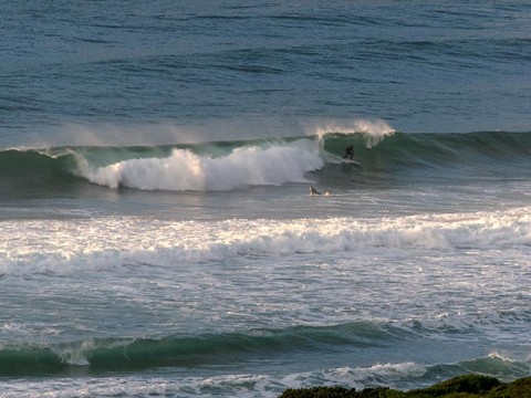
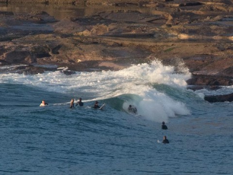
Early risers got the best of it I’d say. Light offshore breezes, low tide and nearly 2 metres of 10 second SE swell was delivering chest to shoulder plus wave faces at optimally angled stretches such as the centre of the Dee Why to Longy stretch. The point was much less consistent and smaller and the same applied to Longy bombies, etc. Around at Collaroy-Narrabeen it was much smaller, in fact it was pretty close to flat at Collaroy, maybe knee plus along most of the rest of the beach and roughly waist at Northy.
Tide was low at 0715 and will be back to high at 1315.
Swell energy should continue to decline this morning and by high tide it’s likely to be pretty tiny. Wind is expected to be onshore from the SE most of the day.
Tomorrow looks like being really small with NW wind. The Bureau and the models are saying about a metre of 7-8 sec SE wind chop is all we’ll have to work with.
Overnight into Monday we’re set to get another solid south pulse. Annoyingly, it’ll be accompanied by south wind in the 10-15 kt range. Tuesday could possibly see some fun-size remnant south swell with light winds as the pulse weakens away. The remainder of the work week should have a little something for the early sessions, but the trend is a gradual downward slope toward flatness by the weekend.
So get in if you can and enjoy your Saturday!

Weather Situation
A high pressure system west of Tasmania is extending a ridge into New South Wales while moving slowly east. Light to moderate winds will feature in most coastal areas during Saturday as the high moves overhead, before the next trough brings a fresh southerly change to the south overnight, continuing northwards through Sunday. Following this, another high looks set to move across the region at the start of the new week.
Forecast for Saturday until midnight
Winds
South to southeasterly 10 to 15 knots becoming north to northeasterly in the evening.
Seas
Below 1 metre.
Swell
Southerly 1.5 to 2 metres, decreasing to 1.5 metres during the afternoon.
Weather
Partly cloudy. 50% chance of showers inshore, 30% chance elsewhere.
Sunday 12 April
Winds
Northwesterly 10 to 15 knots shifting southerly 15 to 20 knots in the morning.
Seas
Around 1 metre, increasing to 1 to 1.5 metres during the morning.
Swell
Southerly 1 to 1.5 metres, decreasing below 1 metre during the morning, then increasing to 1 to 1.5 metres later in the evening.
Weather
Partly cloudy. 40% chance of showers.
Monday 13 April
Winds
Southerly 10 to 15 knots.
Seas
1 to 1.5 metres.
Swell
Southerly 1.5 to 2 metres, increasing to 2 to 4 metres during the day.
Weather
Partly cloudy. 30% chance of a shower.

