Hello Friends,
Looks pretty unpromising for today in Sydney. The MHL buoys were offline when I checked around 0500, but given yesterday’s conditions and the Bureau’s forecast, I’m reasonably confident in saying that this morning’s surf hunt will be challenging to say the least. The models pretty much all agree that it’ll be puny for the next three days in Sydney. But from Thursday on it should be southerly both in terms of swell and wind. Unfortunately, many of the models are showing maybe SSW early on Thursday as the swell starts to ramp, but then the next three days look not too good wind wise, despite there predicted solid south swell. Late in the weekend maybe…?
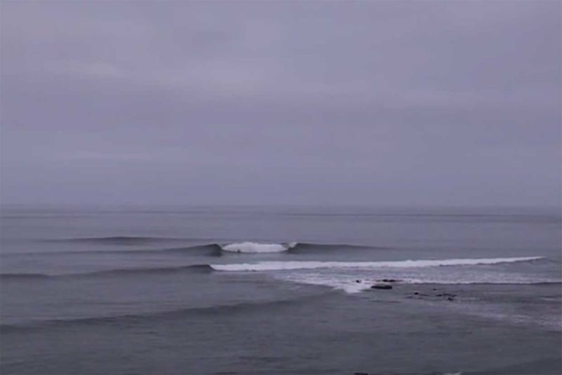
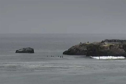
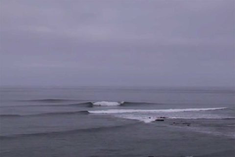
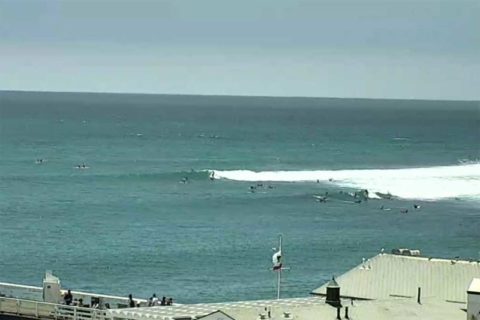
As is typical for this time of year, the wave activity in Santa Barbara is, well, there isn’t any. I checked the Surfline cams and it looks as though there’s only a tiny bit up north at Santa Cruz’s Steamer Lane, however the further south you go from Ventura, the bigger the waves get. It’s small but mal-able at Malibu (and not very crowded for a holiday weekend), but the best wave I spotted was at a place way down in San Diego called Birdrock. There must have been a shark alarm or something because it appeared to be perfect, glassy chest to shoulder with a couple people out.
Have yourself a great Monday everyone!
Weather Situation
A high pressure system lies over the Tasman Sea, while a trough and cold front approach New South Wales from the southwest. A low pressure centre will develop within the trough as it moves over Victoria later today, then move eastwards and deepen as it reaches the Tasman Sea on Tuesday. This should see westerly winds strengthen along most of the coast before shifting more southerly on Wednesday and Thursday as the low moves away to the east. A new high pressure system will develop over the coast at the end of the week, accompanied by easing winds.
Forecast for Monday until midnight
Winds
Northwesterly 10 to 15 knots, reaching 20 knots offshore during the afternoon and evening.
Seas
Below 1 metre, increasing to 1 to 1.5 metres offshore.
Swell
Southerly below 1 metre.
Weather
Becoming cloudy.
Tuesday 5 July
Strong Wind Warning for Tuesday for Sydney Coast
Winds
North to northwesterly 15 to 20 knots turning westerly 20 to 30 knots in the evening.
Seas
1 to 1.5 metres, increasing to 2 to 3 metres offshore by evening.
Swell
Easterly below 1 metre.
Weather
Cloudy. 80% chance of showers.
Wednesday 6 July
Winds
West to northwesterly 25 to 35 knots turning southwesterly 30 to 35 knots during the evening.
Seas
2 to 4 metres.
Swell
Southerly 1 to 2 metres, increasing 1.5 to 2.5 metres during the evening.
Weather
Cloudy. 80% chance of rain. The chance of a thunderstorm.


