Hello Friends,
As anticipated, this morning sees micro conditions for Sydney beaches. The MHL buoy’s pre-dawn report showed 0.7 metres of 9-second east wind bump being fanned by light offshores and struggling no doubt with a high tide at 0800. If you somehow found a wave yesterday, your standards are probably about right for today’s offerings.
The prospect of an east coast low has provoked the Goat to issue a rare update to his forecast from last week. Some of the forecast models are generating predictions that are somewhat larger than the Bureau’s current call. Looks as though the weather will be ordinary, particularly on Thursday when there’s expected to be a reasonable amount of rain along with south to SW wind. Could be a bit nicer weatherwise on the weekend and the swell should still be solid.
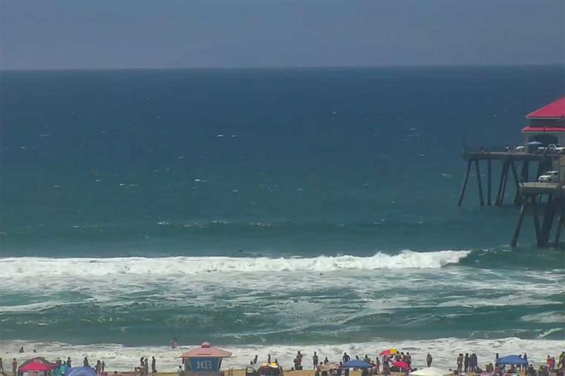
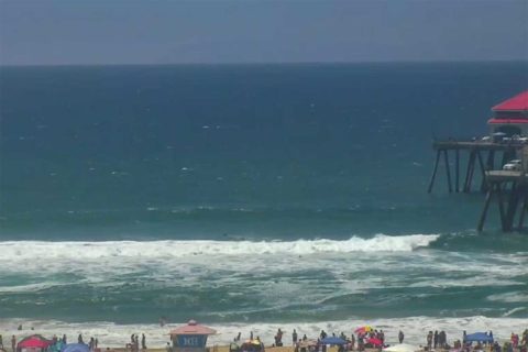
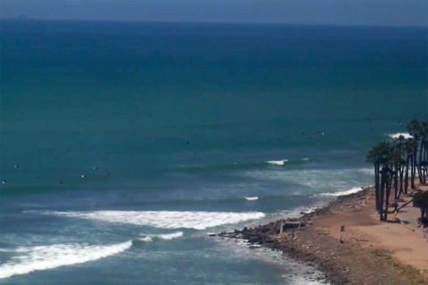
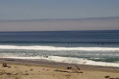
And southern California? Yeah, well, not the best for the big 4th of July holiday – particularly for those of us in the Santa Barbara area.
Today’s framegrabs from the Surfline cams show the paltry conditions from just north of Point Conception at Jalama to Orange county’s Huntington beach. Not too flash, but then again, it is summer… hoping for something from the southern hemisphere toward the weekend…
Have a great Tuesday one and all!
.
.
.
Weather Situation
A high pressure system lies over the Tasman Sea, while a trough and cold front approach New South Wales from the southwest. A low pressure centre within the trough near western Victoria will move eastwards with this system and deepen as it reaches the Tasman Sea on Tuesday. This should see westerly winds strengthen along most of the coast before shifting more southerly during Wednesday or Thursday as the low moves away to the east. A new high pressure system will develop over the coast at the end of the week, accompanied by easing winds.
Forecast for Tuesday until midnight
Strong Wind Warning for Tuesday for Sydney Coast
Winds
Northerly 15 to 20 knots turning west to northwesterly 20 to 25 knots during the afternoon and evening. Reaching up to 30 knots offshore in the evening.
Seas
1 to 1.5 metres, increasing to 2 to 3 metres offshore by evening.
Swell
Easterly below 1 metre.
Weather
Cloudy. 90% chance of showers. The chance of a thunderstorm offshore.
Wednesday 6 July
Winds
West to northwesterly 25 to 35 knots turning southwesterly 25 to 30 knots during the afternoon and evening.
Seas
2 to 3 metres, increasing to 2.5 to 4 metres around midday.
Swell
Southerly around 1 metre.
Weather
Cloudy. 80% chance of showers. The chance of a thunderstorm.
Thursday 7 July
Winds
South to southwesterly 25 to 35 knots decreasing to 20 to 25 knots during the evening.
Seas
2.5 to 4 metres, decreasing to 2 to 3 metres during the evening.
Swell
Southerly 2 to 4 metres, decreasing to 3 metres during the evening.
Weather
Cloudy. 90% chance of showers.


