
Hello Friends,
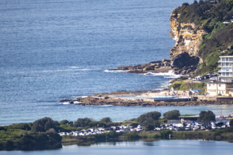
There’s still a metre of 10 seconds east bump out at sea, but it doesn’t look much above ankle to knee high at Dee Why on what is another magnificent morning along the beaches. As the picture shows, the carparks were packing up before 0900 as we head to a high of 27C (UV will be high from 0920 to 1550).
Surf prospects look pretty ordinary across the front half of the week. There’s a hope for a little bump at east swell magnets on Thursday (Wavewatch) or Friday (ECM).
Here’s hoping!
Have a top old Sunday and take the mask for when you can’t maintain safe distance because there are still new cases of COVID-19 appearing every day (18 in NSW yesterday).
Weather Situation
A high pressure system will reach the Tasman Sea today, where it will remain for a number of days, extending a ridge across the state. A low pressure trough will briefly affect southern and central parts of the coast today with another trough set to affect the south on Tuesday.
Forecast for Sunday until midnight
Winds
Northwesterly 10 to 15 knots becoming northeasterly in the early afternoon. Winds shifting south to southeasterly in the evening, possibly reaching 20 knots inshore.
Seas
Around 1 metre.
Swell
Southerly around 1 metre.
Weather
Mostly sunny.
Monday 12 October
Winds
Southeasterly 10 to 15 knots, becoming northeasterly during the morning then increasing to 15 to 25 knots in the evening.
Seas
Below 1 metre, increasing to 1 to 1.5 metres around midday.
1st Swell
Southerly below 1 metre.
2nd Swell
Easterly below 1 metre.
Weather
Partly cloudy.
Tuesday 13 October
Winds
North to northeasterly 15 to 20 knots.
Seas
1.5 to 2 metres, decreasing to 1 to 1.5 metres during the morning.
Swell
Easterly around 1 metre.
Weather
Sunny.


