Hello Friends,
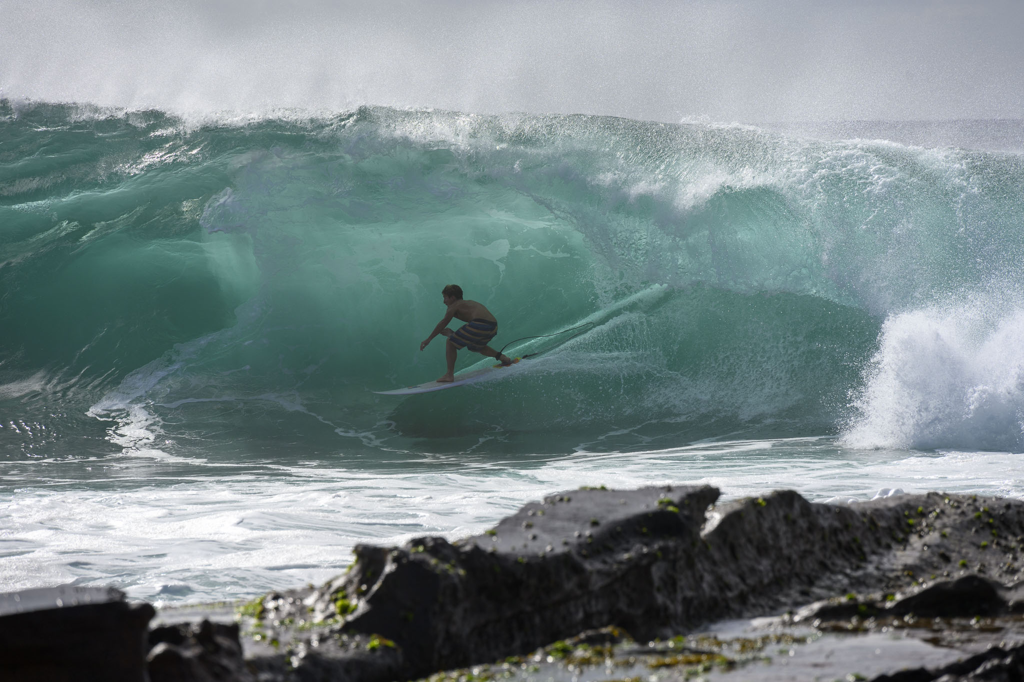
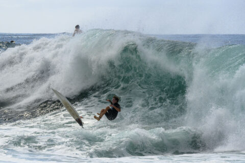
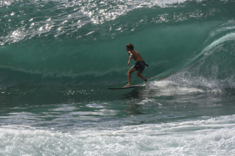
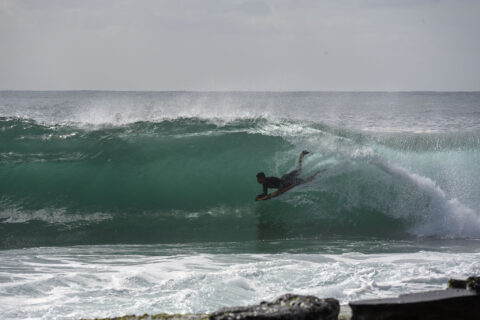
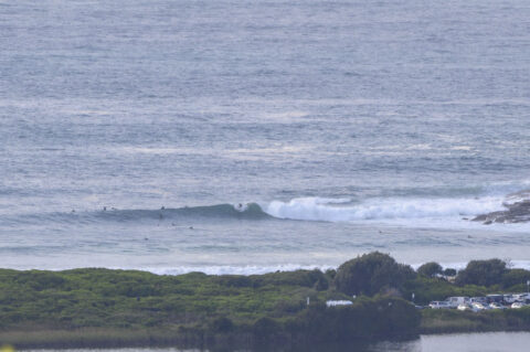
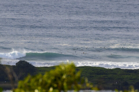
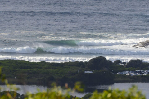
Swell at sea was in the 2-3 metre range from the SE at 14 seconds apart, so bomb sets at Dee Why this morning looked to be in the 2x overhead range. When I grabbed the day’s first pics around 0830, people were sitting pretty far north of the point, suggesting that there are still some bomb sets. It also looked to be reasonably consistent.
Wind was 5-6 kts from the WNW, so surface conditions were smooth for the start of play. Tide is currently dropping to the low at 1045 as we head to a high of 27C along the coast. Wind’s expected to drift around to the NE and come up this afternoon, so as usual, the morning session will be cleanest. Ocean temp is a balmy 24C.
Just grabbing the camera and board to go for a look around, so hope to have some snaps to share in due course.
Go well!
UPDATE:
Spent over an hour at the point waiting for pictures to happen. Swell was backing off and wind was starting to texture it, but there were a few moments even so.
If you’re feeling as though you missed out, well you did, but only sorta. Yes, there were some solid sets, but there were never fewer than 40 people in the water chasing them. Plus, the low tide and swell angle weren’t optimal. And cleanish, makeable ones were way too infrequent for the population density. I’d say most people would be happy to have caught a couple waves in an hour.

Weather Situation
A slow-moving high pressure system near Tasmania is extending a ridge along the New South Wales coast, while a deep low has moved across the southern Tasman Sea and generated a large southerly swell. Winds will turn northeasterly later today as the high moves to the Tasman Sea, although a powerful swell is likely to linger. The next trough and southerly change are forecast to reach the southern part of the coast on Monday and then continue north on Tuesday.
Forecast for Sunday until midnight
Winds
Southerly 10 to 15 knots before dawn, tending variable about 10 knots in the early morning, then becoming northeasterly 15 to 20 knots in the afternoon and evening
Seas
Around 1 metre, increasing to 1 to 1.5 metres inshore during the evening.
Swell
Southerly 3 to 4 metres, decreasing to 2 to 3 metres in the afternoon.
Weather
Partly cloudy.
Caution
Large and powerful surf conditions are expected to be hazardous for coastal activities such as crossing bars by boat and rock fishing.
Monday 8 March
Winds
North to northeasterly 15 to 20 knots.
Seas
1 to 1.5 metres.
1st Swell
Southerly 2 to 2.5 metres, decreasing to 1 to 1.5 metres during the morning.
2nd Swell
North to northeasterly around 1 metre.
Weather
Partly cloudy. 50% chance of showers. The chance of a thunderstorm in the afternoon and evening.
Tuesday 9 March
Winds
Northwesterly 10 to 15 knots shifting south to southwesterly in the morning, then becoming southeasterly during the afternoon.
Seas
1 to 1.5 metres.
1st Swell
Northeasterly 1 to 1.5 metres.
2nd Swell
Southerly around 1 metre.
Weather
Partly cloudy. The chance of a thunderstorm.


