
Hello Friends,
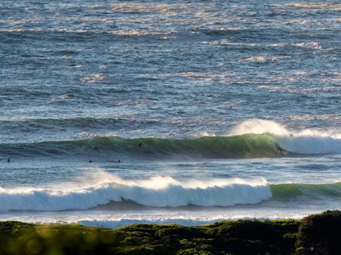
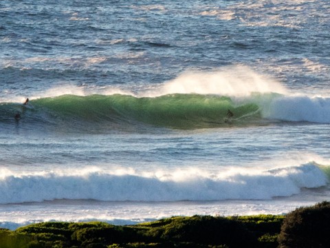
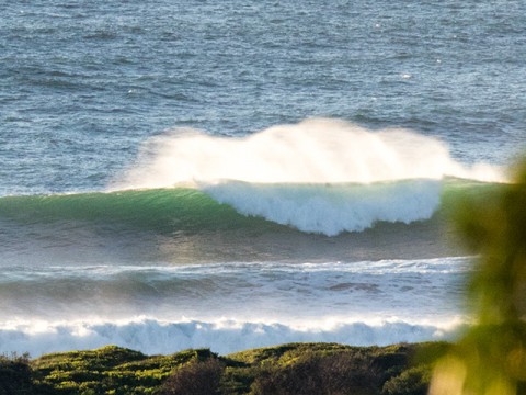
Serious swell this morning – right in line with the forecasts. It’s coming out of the SE at around 10 seconds apart and if the Pt Kembla buoy data is similar to Sydney, it’s around the 4 metre mark at sea. And there could be more to come, because Eden is clocking 5.5 metres. Dee Why point is 1.5-2x overhead on the biggest sets and I couldn’t see anyone up the beach – probably just too crazy to get out the back because there are some rideable looking monsters there too.
Surface conditions are kinda lumpy and choppy looking, but the wind was straight offshore as the day got started. The Bureau says we can expect it to ramp up into the 15-25kt range from the SW later.
Tide was high at 0545 and will be back to low at 1235.
Beachwatch has given the all-clear for most of Sydney’s beaches too.
Obviously this isn’t a day for beginners, so if you’re just starting out surfing, be extremely cautious.
Swell looks like pumping for another 24 hours, although the strong SW’ly will be a factor too. From tomorrow afternoon it’s supposed to go south and stay that way for Sunday as the swell begins to gradually fade.
Have a great Friday everyone and expect a picture or two from me later!
Weather Situation
A low pressure centre is deepening within a trough over the Tasman Sea, while a high lies to the southwest of Tasmania. The low is expected to shift southwest towards Tasmania then remain very slow-moving through the next few days as the high passes to its south. This pattern will maintain generally southerly winds along the New South Wales coast, reaching strong to gale force for a period in southern and central areas. During the weekend the low is forecast to gradually weaken and move away to the east, with a new high south of the Bight extending a ridge along the New South Wales coast.
Forecast for Friday until midnight
Strong Wind Warning for Friday for Sydney Coast
Winds
Southwesterly 15 to 25 knots, reaching up to 30 knots offshore during the day.
Seas
2 to 3 metres.
Swell
Southerly 3 to 4 metres.
Weather
Mostly sunny day. 30% chance of a shower this evening.
Caution
Large and powerful surf conditions are expected to be hazardous for coastal activities such as crossing bars by boat and rock fishing.
Saturday 31 January
Strong Wind Warning for Saturday for Sydney Coast
Winds
Southwesterly 15 to 25 knots, reaching up to 30 knots offshore early in the morning. Winds turning southerly 10 to 15 knots in the early afternoon.
Seas
1.5 to 2.5 metres, decreasing to 1 metre during the morning.
Swell
Southerly 2.5 to 3 metres, increasing to 2.5 to 4 metres offshore.
Weather
Partly cloudy. 20% chance of a shower.
Caution
Large and powerful surf conditions in the early morning are expected to be hazardous for coastal activities such as crossing bars by boat and rock fishing.
Sunday 1 February
Winds
Southerly 10 to 15 knots.
Seas
Below 1 metre.
Swell
Southerly 1.5 to 2.5 metres.
Weather
Partly cloudy. 40% chance of showers.


