
Hello Friends,
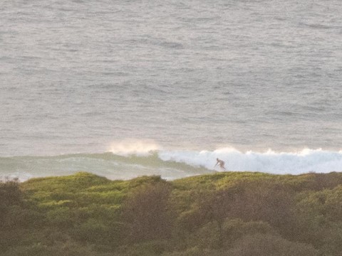
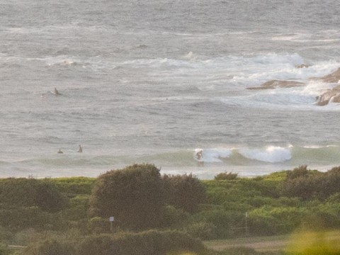
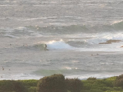
Conditions were pretty reasonable this morning at 0700. We had light westerly wind, a dropping tide (low’s at 1015) and nearly 2 metres of 9-second east swell. Set wave faces were around the chest high mark from Dee Why beach to No Man’s and similar if a bit less consistent at the point.
Wind should drift around to the east this morning and be more NE by this evening. As usual, the earlier you’re into it, the better.
Have yourself a top old Friday, and keep on smilin’!
Hello Friends,
Weather Situation
A strong high centred near New Zealand extends a ridge to the northwest, and is directing generally east to northeasterly winds along the New South Wales north coast. A weakening trough lies through the Illawarra coast. A new high is expected to move across from the west in its wake, and should remain slow-moving over the southern Tasman Sea during the weekend.
Forecast for Friday until midnight
Winds
Easterly 10 to 15 knots turning northeasterly in the evening.
Seas
Below 1 metre.
Swell
Easterly 1.5 metres.
Weather
Partly cloudy. 80% chance of showers. The chance of a thunderstorm.
Saturday 14 February
Winds
Northeasterly 10 to 15 knots.
Seas
Around 1 metre.
Swell
Easterly 1.5 metres.
Weather
Partly cloudy. 50% chance of showers.
Sunday 15 February
Winds
North to northeasterly 15 to 20 knots.
Seas
Around 1 metre, tending 1 to 1.5 metres during the evening.
Swell
Easterly 1 to 1.5 metres.
Weather
Partly cloudy. 50% chance of showers.

