
Hello Friends,
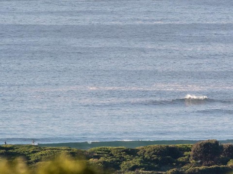
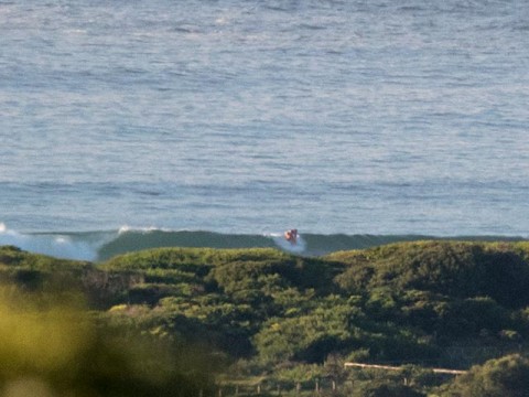
Sparkling Monday morning in Dee Why, but only a weak SSE wind swell dribbling in for would-be surfers. At 0700 there were a few folks having a go in the knee plus and glassy conditions. Waves were few and far between and looked to be pretty weak and slow. SUPs and mals were needed.
Tide’s high at 0920 this morning, so that’s helping to make the already marginal conditions more so.
The Bureau’s modelling projects the swell will fade across the day.
Outlook for the coming week has veered away from hopeful toward problematic in the latest forecasts. There’s a strong wind warning for west to NW tomorrow and swell energy levels look, if anything, likely to be less than now. A 2-metre, 10-sec south pulse is still on the cards for late Wednesday into Thursday. The wind call is for 25-30 kts of westerly going SW Weds. Thursday’s looking more interesting with some modelling projecting 2.5 metres of 11-sec swell and 10-15kts of westerly for the early. I’m blocking that day out for surfin’ at this stage…
The very long range models are all over the place for next week but at least one of them is calling for pumping south swell conditions Mon the 13 and Tue the 14th…
Have a great Monday and keep on smilin’!
Weather Situation
Northeasterly winds will develop along the coast later today ahead of a trough approaching from the west. During Tuesday, a low pressure centre within the trough is expected to deepen off the southern New South Wales coast. This is forecast to bring freshening winds to much of the coast, likely becoming strong to gale force in the south during Wednesday as the low reaches peak intensity. On Thursday the low should move steadily away to the east as a strong high south of the Bight draws closer.
Forecast for Monday until midnight
Winds
Variable about 10 knots becoming northeasterly 15 to 20 knots in the afternoon and evening.
Seas
Below 1 metre, increasing to 1 to 2 metres by evening.
1st Swell
East to northeasterly 1 to 1.5 metres.
2nd Swell
South to southeasterly around 1 metre.
Weather
Mostly sunny day. 80% chance of showers late this afternoon and evening. The chance of a thunderstorm late this afternoon and evening.
Tuesday 7 April
Strong Wind Warning for Tuesday for Sydney Coast
Winds
North to northeasterly 15 to 25 knots turning west to northwesterly in the morning, reaching 30 knots in the evening.
Seas
1.5 to 2.5 metres, increasing to 2 to 3 metres during the afternoon.
1st Swell
Easterly 1 to 1.5 metres.
2nd Swell
Southerly around 1 metre.
Weather
Partly cloudy. 60% chance of showers.
Wednesday 8 April
Winds
Westerly 25 to 30 knots increasing to 40 knots before turning south to southwesterly 20 to 30 knots during the morning.
Seas
1.5 to 2.5 metres, increasing to 2 to 4 metres offshore.
Swell
Southerly 1 to 1.5 metres, increasing to 2 to 3 metres during the morning.
Weather
Partly cloudy. 30% chance of a shower.


