
Hello Friends,
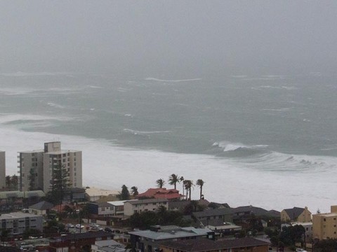
Howling all night and howling as the day got started. Dark grey skies, occasionally lashing rain and SSE wind in the 35-40 kt range as of 0600. The MHL Sydney buoy was seeing close to 7 metres of 11-sec SSE swell at 0500. Meanwhile, from about Port Macquarie north, winds are light to offshore and swell is around the 3.5 metre mark at 14 seconds under mostly clear skies!
Today should see the peak of the storm for Sydney and by tomorrow both swell and wind will begin to drop back into the 3 metre range and by Thursday it’s looking like around 1-2 metres but still windy. By Friday wind should be offshore, skies sunny and swell around the metre mark.
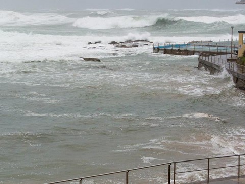
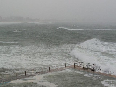
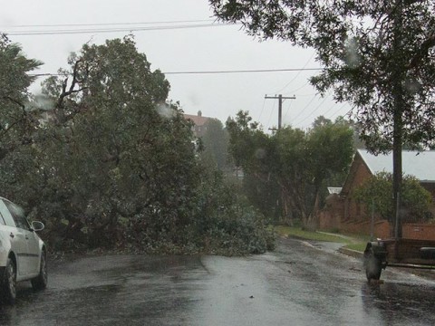
Had to drive to Manly early, so grabbed some pics. Lots of lights out along the way and saw 4 or 5 downed trees. The playing fields at Manly were lakes and Manly lagoon was backing up to such an extent that it was nearly to the height of the bridge at Pittwater. And high tide isn’t until 1015, so I reckon there’s a chance of flooding.
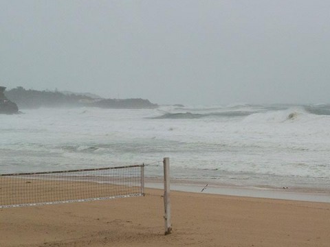
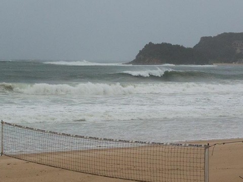
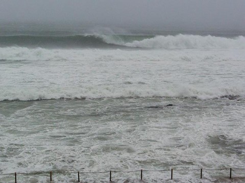
It was offshore and clean looking at south Manly but wildly out of control. You’d be bonkers to go out in that stuff. And Queenscliff was off the richter. Just white water half way out to the bombie. The Bower may possibly have had a wave, but it was hard to tell through all the rain.
Dee Why was nuts too. No point even thinking about it.
Around at Collaroy the wind was offshore and the Kick was double to triple overhead and doing a passable imitation of a right point, but again, you’d be crazy to be out there. Collaroy was unrideable.
Stay inside and keep warm and dry everybody!
Weather Situation
An intense low pressure system has developed near the boundary of the Hunter Coast and Mid North Coast, and is expected to move gradually southwards later today. Gale force winds are being generated on the southern side of this low, and may reach storm force over the Hunter Coast today. Dangerous surf conditions resulting from this system should persist into Wednesday. Later on Wednesday and Thursday the low is forecast to weaken into a trough and lose influence on the NSW coast as a ridge extends across from the west.
Forecast for Tuesday until midnight
Gale Warning for Tuesday for Sydney Coast
Winds
South to southeasterly 30 to 40 knots, reaching 45 knots at times.
Seas
4 to 6 metres.
Swell
Southeasterly 3 to 5 metres.
Weather
Cloudy. 95% chance of rain, heavy at times. The chance of a thunderstorm offshore.
Caution
Large and powerful surf conditions are expected to be hazardous for coastal activities such as crossing bars by boat and rock fishing.
Wednesday 22 April
Gale Warning for Wednesday for Sydney Coast
Winds
Southeast to southwesterly 20 to 30 knots, reaching 40 knots inshore in the morning, tending southerly 15 to 25 knots in the afternoon.
Seas
3 to 5 metres, decreasing to 2 to 3 metres around midday.
Swell
Southeasterly 2 to 4 metres, tending southerly 1 to 2 metres during the morning.
Weather
Cloudy. 80% chance of showers. The chance of a thunderstorm.
Caution
Large and powerful surf conditions are expected to be hazardous for coastal activities such as crossing bars by boat and rock fishing.
Thursday 23 April
Winds
Southwesterly 25 to 35 knots decreasing to 20 to 25 knots during the evening.
Seas
2 to 3 metres, decreasing below 2 metres during the evening.
1st Swell
Southerly 2 to 3 metres, decreasing to around 1 metre during the afternoon or evening.
2nd Swell
Easterly around 1 metre.
Weather
Cloudy. 50% chance of showers. The chance of a thunderstorm.

