Hello Friends,
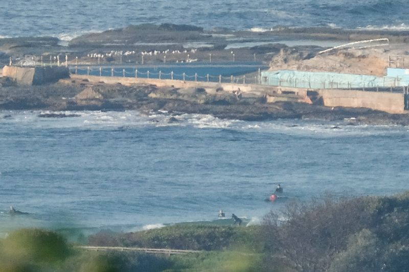
This morning saw mainly clear skies and light WSW wind with about a metre of 8-sec mainly east wind swell. Tide was high at 0820, so there was that too. The on-water arrangments consisted of knee to waist along the beach and maybe ankle to knee at the point.
The Bureau tells us these conditions won’t last for much longer though. There’s a strong wind warning (SW going to south) for later and an 80% chance of rainfall. So dial down the expectations and get in ASAP.
Outlook for tomorrow is for more and showery weather tomorrow. It looks as though there might be a possibility of SW wind for the early as the swell’s due to be picking up.
The Goat’s latest forecast is up and as usual I reckon it’s right on.
Go well with your Friday one and all!

Weather Situation
A high pressure system over the southeastern Tasman Sea is moving east maintaining a ridge to the northwest and directing north to northeasterly winds along the New South Wales central and north coast. A cold front is currently bringing fresh southerly winds to the south coast, and will extend to the central coast during Friday morning and to the far north coast by early Saturday. Winds will be strong at times today and during Saturday. Winds will steadily turn southeast to northeasterly during Sunday and Monday as another high pressure system moves over the southern Tasman Sea.
Forecast for Friday until midnight
Strong Wind Warning for Friday for Sydney Coast
Winds
North to northwesterly about 10 knots shifting southwesterly 15 to 25 knots in the morning then tending southerly in the early afternoon. Winds reaching up to 30 knots in the late evening.
Seas
Below 1 metre, increasing to 1 to 1.5 metres during the morning, then increasing to 1 to 2 metres around midday.
1st Swell
Southerly around 1 metre, increasing to 1 to 1.5 metres later in the evening.
2nd Swell
Easterly around 1 metre.
Weather
Becoming cloudy. 70% chance of showers. The chance of a thunderstorm from late this morning.
Saturday 23 April
Strong Wind Warning for Saturday for Sydney Coast
Winds
South to southwesterly 20 to 30 knots tending south to southeasterly 20 to 25 knots during the day.
Seas
1.5 to 2.5 metres.
Swell
Southerly 1.5 metres, increasing to 2 to 3 metres during the morning.
Weather
Partly cloudy. 70% chance of showers. The chance of a thunderstorm in the early morning.
Sunday 24 April
Winds
Southeasterly 15 to 20 knots.
Seas
1.5 to 2 metres, decreasing to 1 to 1.5 metres during the morning.
1st Swell
South to southeasterly 2 to 2.5 metres, decreasing to 1 to 2 metres during the morning.
2nd Swell
Easterly around 1 metre, tending southeasterly 1 to 2 metres during the afternoon or evening.
Weather
Partly cloudy. 60% chance of showers.


