Hello Friends,
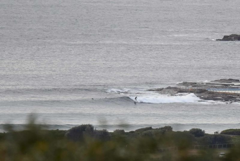
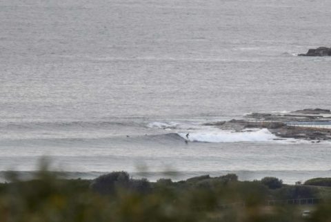
Yesterday’s solid and consistent SSE swell (pics up soon) has dropped from around 2 metres to a touch over 1 metre. Average period’s still over 11 seconds though and that means the odd chest high set at the point and likely similar along the beach. Couldn’t be certain about the latter because there weren’t any surfers visible up that way.
Wind was light west for the early and is expected to pick up from the NW. At the same time, the swell may decrease steadily across the day. Tide was high at 0700 and is dropping back to the low at 1240.
It looks like tomorrow’ll be small in the morning but then the SW wind will start to kick up and we should see an increase in the swell energy- although quality may not be there at most spots. Wednesday the Bureau tells us will see strong SW wind and a ramping south swell along with an 80 per cent chance of rain.
After that it would seem that we’re in for a run of swell through to mid next week. And some of the forecasts are showing some pretty big stuff Thursday and Friday – with heaps of SSE wind unfortunately.
Go well with your Monday!
.
.
Weather Situation
A high is over northern New South Wales and a strong cold front currently over the Bight is expected to move along the New South Wales on Tuesday. A deep low pressure system is likely to develop over the Tasman Sea later on Tuesday. A vigorous airstream around the low is likely to persist for the remainder of the week as it moves slowly east.
Forecast for Monday until midnight
Winds
West to northwesterly 10 to 15 knots tending north to northwesterly in the morning. Reaching up to 20 knots offshore in the evening.
Seas
Around 1 metre, increasing to 1 to 1.5 metres offshore by early evening.
Swell
Southerly 1.5 to 2 metres, decreasing to 1 to 1.5 metres during the morning.
Weather
Becoming cloudy. 20% chance of rain.
Tuesday 2 August
Strong Wind Warning for Tuesday for Sydney Coast
Winds
Northwesterly 10 to 15 knots turning southwesterly 15 to 25 knots in the middle of the day. Reaching up to 30 knots during the afternoon and evening.
Seas
1 to 2 metres increasing to 2 to 3 metres during the afternoon.
Swell
Southerly around 1 metre, increasing to 1.5 to 2 metres during the afternoon.
Weather
Cloudy. 90% chance of rain.
Wednesday 3 August
Winds
Southwesterly 30 to 35 knots increasing to 35 to 45 knots during the morning then turning southerly during the evening.
Seas
3 to 4 metres, increasing to 4 to 6 metres during the afternoon.
Swell
Southerly 3 to 4 metres, increasing to 4 to 6 metres during the afternoon or evening.
Weather
Cloudy. 80% chance of showers. The chance of a thunderstorm.


