
Hello Friends,
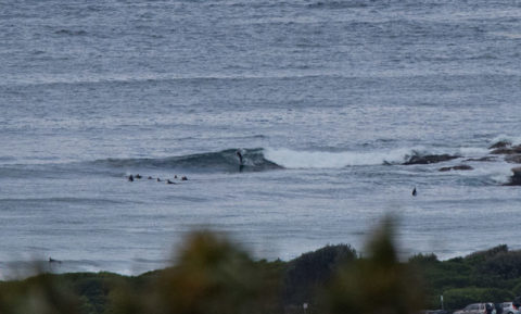
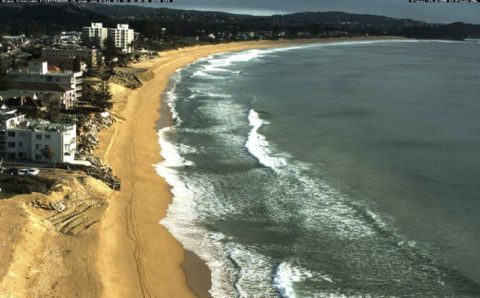
2.4 metres of 8 second south swell rolling into Dee Why this morning. The point was showing a soft chest high set every now and then. Further up the beach it looked to be similar size but not quite as clean. The Bureau says we can expect the swell to build across the day. The MHL Eden buoy is at 4.6 metres at 10 seconds from the SSE…
Tide’s low as I write this just before 0900 and will be back to high at 1520. By then the wind is predicted to have been coming from the south since about lunch time.
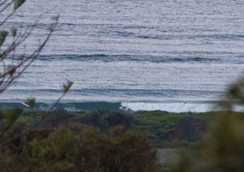
The takeaway? Go now, because this afternoon’s surf options will be limited to very protected south corners.
Tomorrow morning is really looking interesting for experienced and fit surfers. Swell’s projected to be 3-4 metres south at 11-13s so we’re talking solidly overhead at the magnets. The energy should still be going on Tuesday too.
Have fun and take care!
Weather Situation
A vigorous southerly change associated with a cold front with a low to the south crossing the Tasman Sea is moving along the New South Wales north coast, with a secondary surge bringing gales to parts of the coast today. Winds will gradually ease during Monday and turn northerly on Tuesday as a high pressure system moves over the Tasman Sea extending a ridge to the north.
Forecast for Sunday until midnight
Gale Warning for Sunday for Sydney Coast
Winds
West to southwesterly 20 to 30 knots, reaching up to 35 knots offshore early in the morning. Winds turning southerly during the morning and early afternoon.
Seas
2 to 3 metres, increasing to 2.5 to 4 metres offshore.
Swell
Southerly 1 to 2 metres, increasing to 2.5 to 3 metres during the morning, then increasing to 3 to 4 metres during the afternoon.
Weather
Partly cloudy. 60% chance of showers offshore, 20% chance elsewhere.
Caution
Large and powerful surf conditions are expected to be hazardous for coastal activities such as crossing bars by boat and rock fishing.
Monday 24 October
Winds
Southwesterly 15 to 20 knots turning southerly in the early afternoon.
Seas
1.5 to 2.5 metres, decreasing to 1 to 1.5 metres around midday.
Swell
Southerly 3 to 4 metres.
Weather
Mostly sunny. 30% chance of a shower offshore in the morning.
Caution
Large and powerful surf conditions are expected to be hazardous for coastal activities such as crossing bars by boat and rock fishing.
Tuesday 25 October
Winds
South to southwesterly 10 to 15 knots turning west to northwesterly below 10 knots during the morning then tending north to northeasterly 15 to 20 knots during the day.
Seas
Around 1 metre, increasing to 1 to 1.5 metres during the afternoon or evening.
Swell
Southerly 3 to 4 metres, decreasing to 2 to 3 metres during the morning.
Weather
Partly cloudy.


