

Hello Friends,
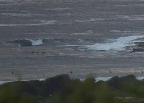
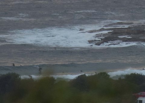
Mild, mostly cloudy start to Friday. Wind was light SW which meant smooth conditions for the early crew at Dee Why. Swell was around the 2.5 m mark and 10 seconds apart out of the SSE (158°). It looked to be in the chest to head high range on sets, but the inbound 0925 1.94 m high tide was making it very full.
Weather Situation
Southerly winds will gradually ease today as a high pressure system in the Bight extends a weak ridge over New South Wales waters. Winds will turn north to northeasterly on Saturday afternoon as this high moves over the Tasman Sea, ahead of another southerly change expected to reach the south coast on Sunday morning.
The wind should come around to the south and then go SE as it pushes into the 15-20kt range. At the same time the Bureau tells us the swell is going to fade back from the overnight peak.
As for the week ahead, the Goat has spoken.
Have a great day everyone!
Forecast for Friday until midnight
- Winds
- Southerly 15 to 20 knots turning southeasterly below 10 knots in the evening.
- Seas
- 1 to 1.5 metres, decreasing below 1 metre around midday.
- Swell
- Southerly 1.5 to 2 metres, decreasing to 1 to 1.5 metres during the morning.
- Weather
- Partly cloudy.
Saturday 3 March
- Winds
- Variable below 10 knots becoming northeasterly 10 to 15 knots in the early afternoon.
- Seas
- Below 1 metre, increasing to around 1 metre during the afternoon.
- Swell
- Southerly around 1 metre.
- Weather
- Mostly sunny.
Sunday 4 March
- Winds
- Northerly 15 to 20 knots tending southeast to southwesterly during the afternoon then tending southwesterly during the evening.
- Seas
- Around 1 metre, increasing to 1 to 1.5 metres inshore during the afternoon.
- Swell
- Northeast to southeasterly below 1 metre.
- Weather
- Partly cloudy. 50% chance of showers.


