
Hello Friends,
Looks like a messy but surfable day at most of Sydney’s beaches. Not amazing quality, but water’s warm and there are even a few shoulder high faces (briefly) to be had at better exposures. Swell at 0800 on the MHL buoy was showing 1.3 metres at 10 seconds mainly from the SE. Wind’s going around to the NE soon. Looks as though there should be fun ones again tomorrow am and with luck you’ll have options on Monday and Tuesday am as well.
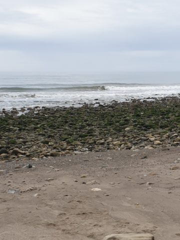
I finally got in the water here today with a mate at a little spot west of Goleta that was picking up knee to waist plus glassy things. Fun on a long board although the water was around 15, so after awhile the 3/2 couldn’t keep me warm enough. Still, just the two of us, so that’s good. Tide was very low too.
Weather Situation
A slow-moving high pressure system over the Tasman Sea is extending a ridge towards the northern New South Wales coast. This pattern is expected to persist into next week, bringing east to northeasterly winds over the northern half of the coast, and north to northeasterly winds over the southern half of the coast. Winds in the south will freshen during the weekend as a cold front passes to the south.
Forecast for Saturday until midnight
- Winds
- Northeasterly 10 to 15 knots.
- Seas
- Around 1 metre, increasing to 1 to 1.5 metres offshore.
- Swell
- Easterly around 1 metre, increasing to 1 to 1.5 metres during the morning.
- Weather
- Partly cloudy. 70% chance of showers. The chance of a thunderstorm.
Sunday 3 March
- Winds
- Northeasterly 15 to 20 knots, reaching up to 25 knots offshore in the late evening.
- Seas
- 1 to 1.5 metres.
- Swell
- Easterly 1.5 metres.
- Weather
- Partly cloudy. 50% chance of showers in the morning and early afternoon. The chance of a thunderstorm in the morning.
Monday 4 March
- Winds
- North to northeasterly 15 to 25 knots.
- Seas
- 1 to 2 metres.
- Swell
- Easterly 1 to 1.5 metres.


