
Hello Friends,
Definitely some waves around this morning for Sydney – and the Bureau says it’ll pick up later. From what I can tell it’s around the chest to shoulder high range at good exposures. The swell looked kinda close together but the MHL buoy is showing 2 metres at 11 sec from the SSE. Water is 20 and wind should be SW most of the day. Looking ahead, well we have the Goat’s latest forecast to mull over.
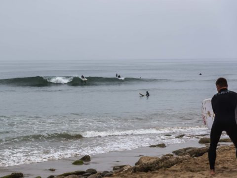
Went for a drive with a mate this morning and can report that Santa Barbara has no waves whatsoever but there were little glassy bumps at Ventura’s California Street. They were real weak so I wasn’t feeling too bad about not getting amongst it.
Weather Situation
A high pressure system will lie over southeast Australia for the remainder of the week. This system will maintain mostly southeast to southwesterly winds over New South Wales waters.
Forecast for Friday until midnight
Strong Wind Warning for Friday for Sydney Coast
- Winds
- Southwesterly 20 to 30 knots tending southerly 25 to 30 knots in the evening.
- Seas
- 1.5 to 2 metres, increasing to 2 to 3 metres around midday.
- Swell
- Southerly 1 to 1.5 metres, increasing to 2 to 2.5 metres by early evening.
- Weather
- Partly cloudy. 95% chance of showers offshore, 60% chance elsewhere. The chance of a thunderstorm.
Saturday 22 June
Strong Wind Warning for Saturday for Sydney Coast
- Winds
- Southerly 20 to 30 knots.
- Seas
- 2.5 to 3 metres.
- Swell
- Southerly 2 to 3 metres.
- Weather
- Cloudy. 95% chance of showers. The chance of a thunderstorm offshore.
Sunday 23 June
- Winds
- Southerly 15 to 20 knots turning southeasterly 10 to 15 knots during the evening.
- Seas
- 1.5 to 2.5 metres, decreasing to 1 to 1.5 metres during the morning.
- Swell
- Southerly 2 to 3 metres.
- Weather
- Cloudy. 95% chance of showers. A thunderstorm likely.
Please be awareWind gusts can be 40 percent stronger than the averages given here, and maximum waves may be up to twice the height.
