Hello Friends,
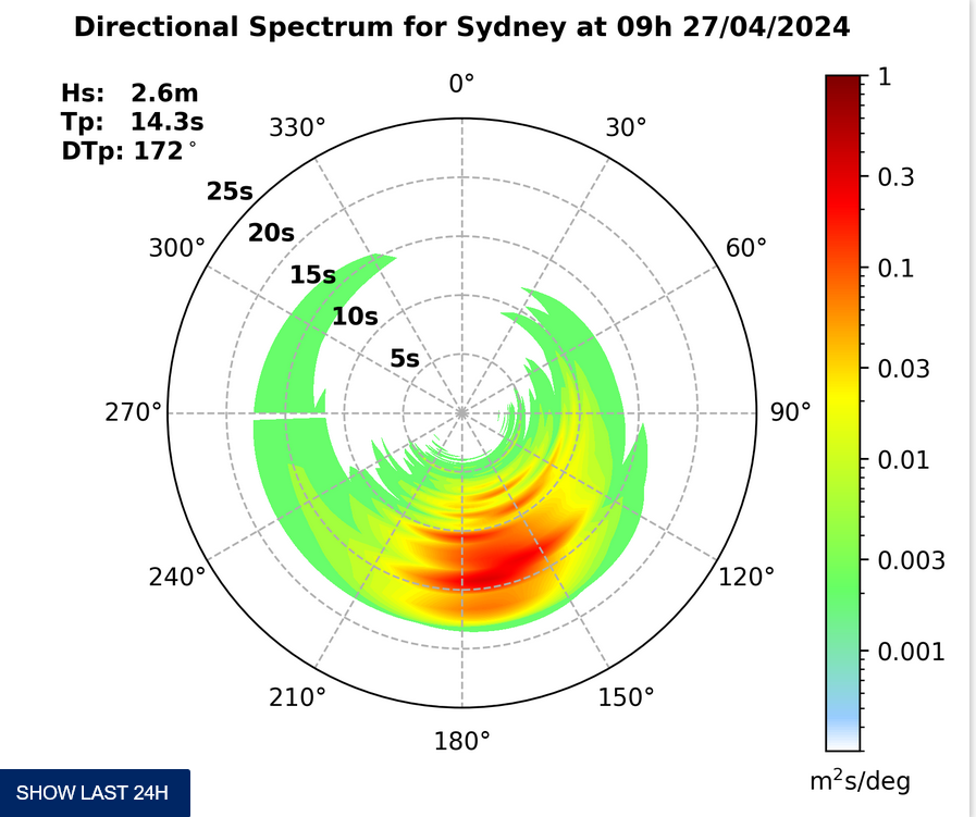
Friday morning in Sydney kicked off with 10-15 kts of easterly wind chopping it up everywhere. Out at sea, the swell was coming from 116° at 2.25 metres at 9 seconds apart. There’s a 90% chance of rain today and Beachwatch has flagged water qualityMona Vale, North Narrabeen and the Dee Why to Longy stretch as “pollution possible” .
Just back from Manly and can report nowhere is surfable – unless you really love windtorn, biggish shutdowns.
May put up a picture later, but it’s looking like rain right now.
Weather Situation
A broad low pressure trough lies off the northern New South Wales coast and a high is drifting across the southern Tasman Sea. Southeasterly winds will tend northeasterly along central and southern parts on Friday and Saturday as the high drifts further east and then stalls. On the weekend, the trough is forecast to deepen and form a low pressure system over the western Tasman Sea, which may bring strong south to southeasterly winds and large waves to parts of the coast from Sunday.
Forecast for Friday until midnight
Winds
Easterly 10 to 15 knots, reaching up to 20 knots offshore early in the morning and again in the late evening. Winds tending northeasterly in the evening.
Seas
1 to 1.5 metres, decreasing to 1 metre during the morning.
Swell
Easterly 2.5 metres.
Weather
Cloudy. 90% chance of showers. The chance of a thunderstorm.
Saturday 20 February
Winds
Northeasterly 15 to 20 knots turning east to southeasterly 10 to 15 knots early in the morning.
Seas
1 to 1.5 metres, decreasing to 1 metre during the morning.
Swell
Easterly 2.5 metres.
Weather
Cloudy. 90% chance of showers. The chance of a thunderstorm.
Sunday 21 February
Winds
Variable about 10 knots becoming southeasterly 10 to 15 knots during the morning then tending southerly during the afternoon.
Seas
Around 1 metre.
Swell
Easterly 2.5 to 3 metres.
Weather
Cloudy. 90% chance of showers. The chance of a thunderstorm


