Hello Friends,
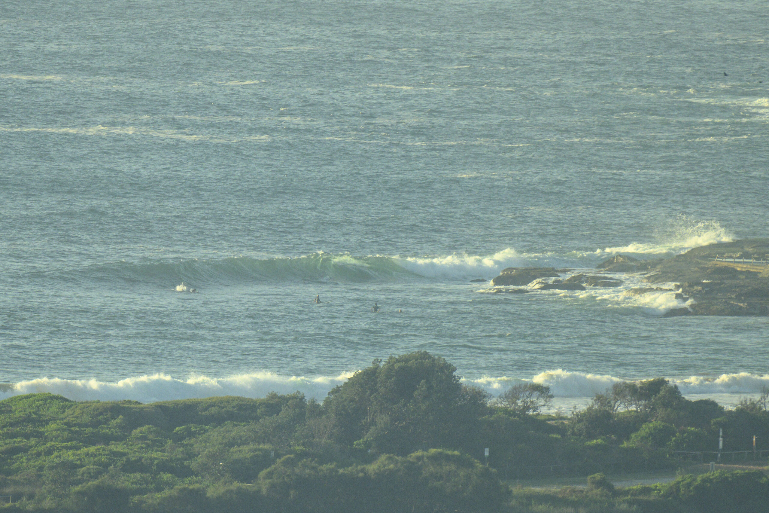
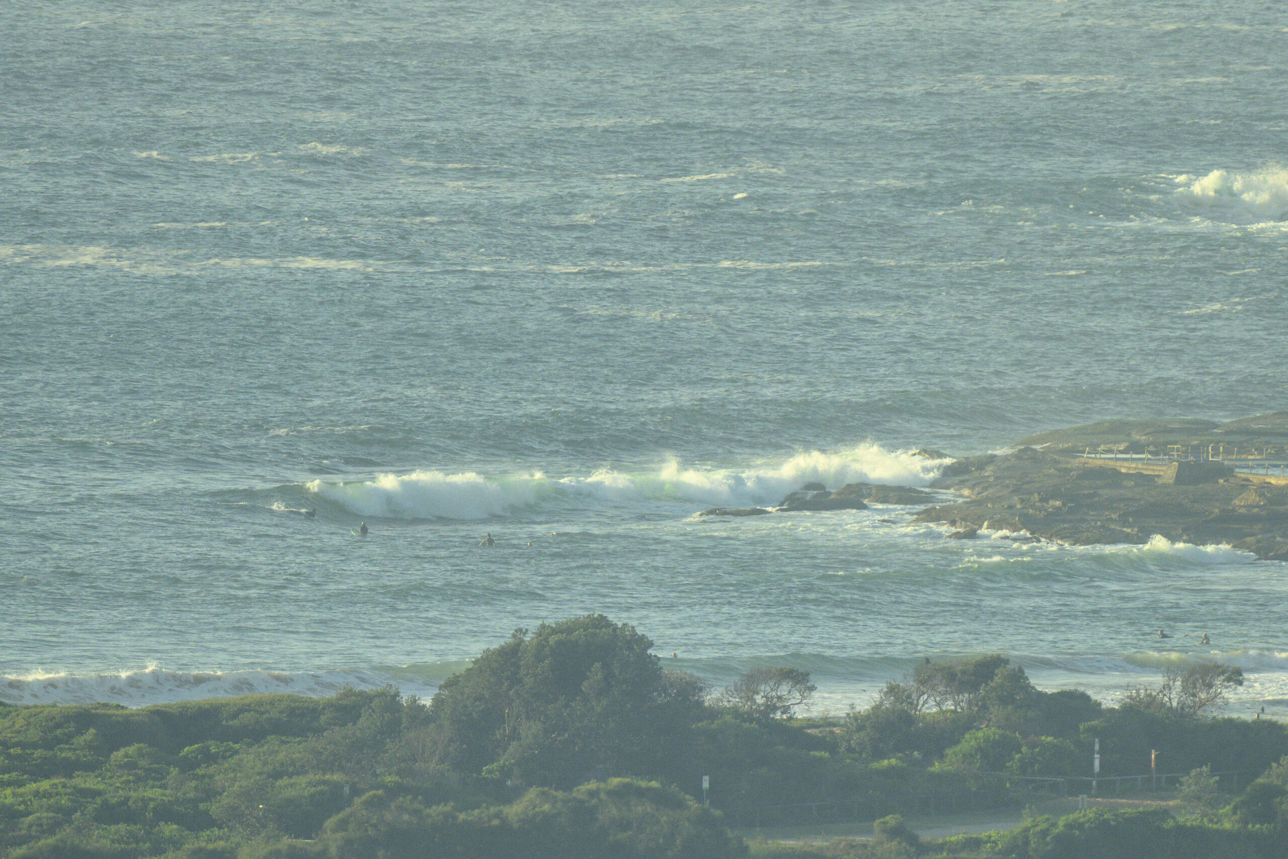
Shoulder high sets at the NE magnets this morning thanks to 2 metres of 11-second NE swell, but a north wind was texturing the surface too, and the Bureau tells us it’ll be picking up into the 15-20 kt range ahead of a vigorous south change. Tide is coming off the 0615 low and hits high at 1220. It looks to me as though Dee Why’s not doing much with the swell. There were a few people out at the point, but the sets I saw – though looking promising as they approached – were not catchable. Places like North Narrabeen and North Curl Curl will probably be a better bet. Plus as the wind picks up, they could be a little smoother as well.
Check back later for the latest from the amazing Goat on the surf prospects for the coming week. The weekend doesn’t look great to me, but I wonder what he’ll think of the prospects for Mon-Tue…
Go well!
Weather Situation
A weak ridge extends over the coastal waters. A trough, cold front, and southeasterly wind surge is moving north across the southern waters today, reaching the Hunter coastal waters by the evening, and the northern border on Friday. A high will approach Tasmania on Friday, extending a new ridge over the coastal waters in the wake of the trough. The high will reach the Tasman Sea by Sunday, maintaining the ridge for several days as the high drifts east.
Forecast for Thursday until midnight
Strong Wind Warning for Thursday for Sydney Coast
- Winds
- Northerly 15 to 20 knots shifting southerly 20 to 25 knots in the early afternoon. Winds reaching up to 30 knots in the late evening.
- Seas
- 1 to 1.5 metres, increasing to 1 to 2 metres by early evening.
- 1st Swell
- Southerly around 1 metre.
- 2nd Swell
- Northeasterly around 1 metre inshore, increasing to 1 to 1.5 metres offshore during the afternoon.
- Weather
- Mostly sunny day. 50% chance of showers later tonight.
Friday 15 March
Strong Wind Warning for Friday for Sydney Coast
- Winds
- Southerly 20 to 25 knots, reaching up to 30 knots early in the morning. Winds turning southeasterly 15 to 25 knots early in the morning.
- Seas
- 1.5 to 2.5 metres.
- 1st Swell
- Southerly 1 to 1.5 metres, increasing to 2 to 2.5 metres during the morning, then tending southeasterly 2 to 2.5 metres around midday.
- 2nd Swell
- Northeasterly around 1 metre.
- Weather
- Cloudy. 80% chance of showers. The chance of a thunderstorm offshore.
Saturday 16 March
- Winds
- Southeasterly 10 to 15 knots turning easterly during the morning.
- Seas
- 1 to 1.5 metres, decreasing below 1 metre during the morning.
- 1st Swell
- Southeasterly 2.5 metres, tending southerly 1 to 2 metres during the morning.
- 2nd Swell
- Easterly around 1 metre, increasing to 1 to 1.5 metres during the morning.
- Weather
- Partly cloudy. 80% chance of showers.


