
Hello Friends,
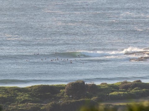
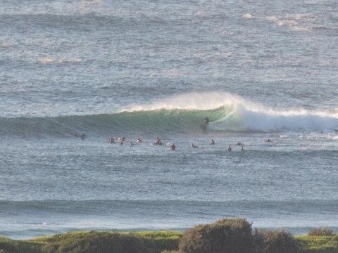
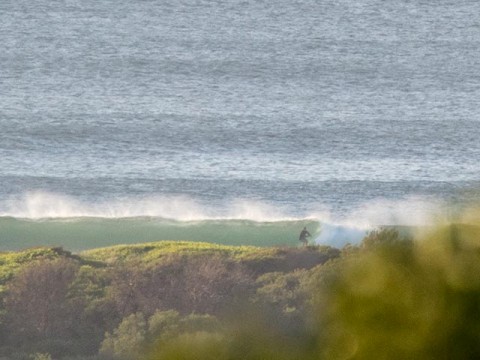
It’s on. Should be good all morning at SSE magnets thanks to 3 metres of 12-sec energy. Gotta jam, more pics and comment later.
Tides: H @0940, L @1555
Weather Situation
A high pressure ridge extending across the state from the west has moderated winds over most of the coast, although southern waters are likely to remain windy today as another front moves into the Tasman Sea. A weak trough is forecast to linger in the south on Saturday, while remaining areas experience a shift to northeasterly winds as a high becomes established over the Tasman Sea.
Forecast for Friday until midnight
- Winds
- West to northwesterly 15 to 20 knots, reaching up to 25 knots offshore in the late morning. Winds shifting east to southeasterly 10 to 15 knots in the early afternoon.
- Seas
- Below 1 metre, increasing to 1 to 2 metres during the morning, then decreasing to 1 metre around midday.
- Swell
- Southerly 3 to 4 metres, decreasing to 1.5 to 2 metres around midday.
- Weather
- Sunny.
- Caution
- Large and powerful surf conditions are expected to be hazardous for coastal activities such as crossing bars by boat and rock fishing.
Saturday 7 March
- Winds
- Variable about 10 knots becoming northeasterly 15 to 20 knots in the early afternoon.
- Seas
- Below 1 metre, increasing to 1 to 1.5 metres during the afternoon.
- Swell
- Southerly 1.5 to 2 metres, increasing to 2 to 3 metres during the morning, then decreasing to 1.5 to 2 metres by early evening.
- Weather
- Partly cloudy.
- Caution
- Large and powerful surf conditions are expected to be hazardous for coastal activities such as crossing bars by boat and rock fishing.
Sunday 8 March
- Winds
- North to northeasterly 15 to 20 knots.
- Seas
- 1 to 1.5 metres.
- Swell
- Southerly 1.5 to 2 metres, decreasing to 1 to 1.5 metres during the morning.
- Weather
- Partly cloudy. 30% chance of a shower.


