Hello Friends,
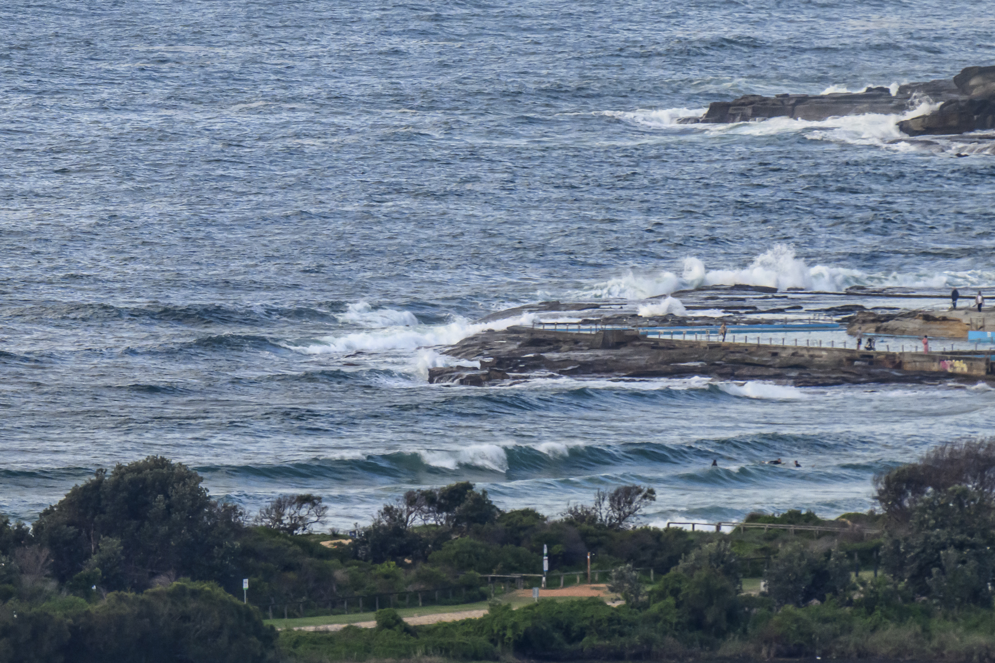
A bit grey this morning for the early but the swell of the last couple days is hanging in there. It’s moved more to the east according to the MHL data (but I reckon there’s still some south component in the mix), but average size has slipped only a touch to be just shy of 2 metres on average out at sea. Average period is down a few cogs from the peak yesterday and is now on 9 seconds. Set wave faces at Dee Why beach were in the head high range and at the point maybe a notch under that.
On current trends, I’d say we can expect the energy to stick around today and I’ve got my fingers crossed for a reasonable chance at fun waves tomorrow morning. The Bureau is talking westerly winds with NE swell to a couple metres – which sounds pretty good to me!
Have yourself a top old Friday one and all.
TIDES: L @0930, H @1610
Weather Situation
A low pressure system lies off the NSW north coast while a strong high pressure system is centred over the Tasman Sea. The low pressure system is expected to weaken and move slowly east today. A cold front is expected to cross NSW this Friday and Saturday with a second cold front moving through on Sunday.
Forecast for Friday until midnightWinds
Northwest to northeasterly 10 to 15 knots.
Seas
Below 1 metre.
Swell
Southeasterly 2 metres tending northeasterly from midday.Saturday 30 June
Winds
Northwesterly 10 to 15 knots turning westerly 15 to 20 knots in the morning.
Seas
1 to 1.5 metres.
Swell
Northeasterly about 2 metres.Sunday 1 July
Winds
Westerly 15 to 25 knots turning southwesterly 25 to 30 knots during the evening.
Seas
1.5 to 2 metres, increasing to 3 metres during the afternoon.
Swell
Easterly 1.5 metres.