


Hello Friends,
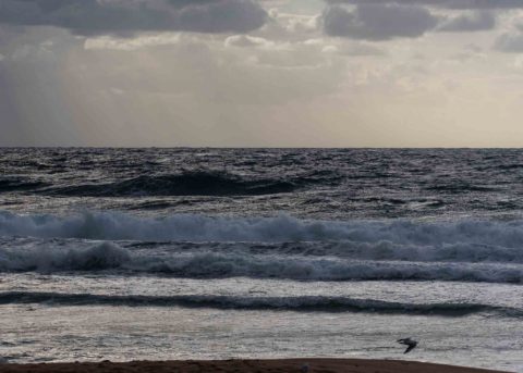
At first light the wind was 20-25 kts from the SSE. Skies were overcast and threatening more showers (there’s a 70% chance). Tide was a 0.46 m low at 0620 and is currently headed to a 1.52 m high at 1225. The wind has pushed up wave heights out at sea but the numbers tell the story: 3 metres SSE at 8 seconds – which means gutless, close together chopped up waist high junk. Lookin’ like a work day folks.
Prospects that were looking slightly hopeful over the last few days seem to have gone a bit sour in the latest batch of forecasts. There seems to be a consensus that the wind will continue out of the south to SE until around Saturday night. Swell energy will come from the same direction, but it doesn’t look like getting much above the waist to chest high level. Periods aren’t expected to get above the 10 sec mark, so protected corners probably won’t see much excitement.
Maybe next week…right now there seems to be some hope for a long period south pulse…but we shall see…
Have a great Tuesday everyone!
Weather Situation
A broad low pressure trough over the western Tasman Sea is directing northeast to southeasterly winds along the New South Wales coast. Winds will turn southeasterly today as a high pressure system moves east of the Bight strengthening a ridge along the coast.
Forecast for Tuesday until midnight
- Winds
- South to southeasterly 20 to 25 knots.
- Seas
- 1.5 to 2.5 metres.
- 1st Swell
- Southerly 1 to 1.5 metres.
- 2nd Swell
- Easterly around 1 metre.
- Weather
- Partly cloudy. 60% chance of showers.
Wednesday 7 March
- Winds
- Southeasterly 15 to 20 knots.
- Seas
- 1.5 to 2 metres, decreasing to 1 metre around midday.
- Swell
- Southeasterly around 1 metre, increasing to 1.5 metres during the morning, then increasing to 1.5 to 2 metres around midday.
- Weather
- Cloudy. 60% chance of showers.
Thursday 8 March
- Winds
- Southeasterly 10 to 15 knots.
- Seas
- Around 1 metre.
- Swell
- Easterly 1 to 1.5 metres, decreasing to around 1 metre during the afternoon.
- Weather
- Cloudy.


