
Hello Friends,
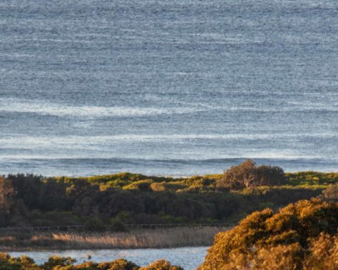
There were half a dozen in the water at the point a little before 0700 this morning. Every now and then a little waist and a bit high line would turn up, but there was no obvious sign of the anticipated big swell. The MHL buoy was showing a little over a metre of 10-second SSE (169°) swell as of 0500.
Wind was WNW at 10-17 kts as of report time, but it, like the swell is expected to come up significantly over the next 24 hours. Tide was low at 0535 and will be back to high a little before noon. Beachwatch says the ocean’s 17C along the Northern Beaches.
Outlook is for the wind to hit 25-30 kts from the west later today, but tomorrow when the swell blows up there’s a gale warning for W-SW 25-40 kts.
As you can see below, the Bureau is telling us we can expect 6-7 metres (!!) by noon tomorrow and it’ll still be in the 5-7 metre range on Friday morning. Apart from Collaroy or the Bower, I’m not sure there’ll be anywhere for ordinary surfers to take part. Here’s hoping the coastal infrastructure rides it out okay. It’s hard to believe there won’t be some pretty noticable impacts on the beaches and dunes. At least they’re fairly wide at the moment.
I’m planning to be out and about with the camera to document the events, so check in for piccies over the next couple of days.
Go well and stay safe!
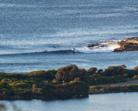
Small line up toward No Mans around 0700
Weather Situation
A strong high pressure system lies near the Bight while a number of fronts, moving across the Southern Ocean, approach New South Wales waters over the coming days. The first of these fronts will clip southern waters this morning, with a second stronger front moving along the entire New South Wales coast on Thursday. These systems will bring periods of vigorous winds until Friday accompanied by very powerful swells.
Forecast for Wednesday until midnight
Strong Wind Warning for Wednesday for Sydney Coast
Winds
Westerly 25 to 30 knots.
Seas
2 to 3 metres.
Swell
Southerly 1 to 1.5 metres, increasing to 1.5 to 2.5 metres by early evening.
Weather
Sunny.
Caution
Large and powerful surf conditions in the afternoon and evening are expected to be hazardous for coastal activities such as crossing bars by boat and rock fishing.
Thursday 22 August
Gale Warning for Thursday for Sydney Coast
Winds
West to southwesterly 25 to 40 knots.
Seas
2 to 3 metres, increasing to 3 to 4 metres around midday.
Swell
Southerly 3 to 4 metres, increasing to 6 to 7 metres around midday.
Weather
Partly cloudy. 50% chance of showers in the morning.
Caution
Large and powerful surf conditions are expected to be hazardous for coastal activities such as crossing bars by boat and rock fishing.
Friday 23 August
Winds
Southwesterly 20 to 30 knots decreasing to 10 to 20 knots during the afternoon.
Seas
2 to 3 metres, decreasing to around 1 metre during the afternoon or evening.
Swell
Southerly 5 to 7 metres, decreasing to 3 to 5 metres during the morning.
Weather
Partly cloudy.
Caution
Large and powerful surf conditions are expected to be hazardous for coastal activities such as crossing bars by boat and rock fishing.


