Hello Friends,
Are we all ready for the heat?
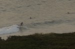
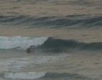
The good news from out here on the coast is that the water is a beautiful 22-23 degrees and there are some little waves. You’ll need to get to a stretch of beach with good exposure to the NE though.
Windswell is averaging around a metre from the NE but because it’s only around 7 seconds apart, there’s not a lot of juice. Like yesterday, you’re going to get the best sections on those that hold up long enough to stand up in the inside.
Here’s the Bureau’s call for today and tomorrow:
Wind: NE 15/20 knots, 20/25 knots offshore, increasing to 25/30 knots generally during the afternoon.Sea: about 2 metres rising to 2 to 3 metres later.Swell: E about 1 metre.
Sunday: Wind: NE 20/30 knots before a S change 20/30 knots late in the day or evening. Sea: 2 to 3 metres Swell: E/NE 1 to 2 metres.
If that wind pushes up to the speeds the Bureau’s talking about, there could be a repeat of the conditions we’ve had over the last couple days, ie the odd chest high bomb set at exposed spots late in the day.
Tomorrow will probably be best early because of the expected late south change. I’d say we’d be going well if Sydney was waist high on Sunday morning.
The coming week looks a little more interesting than it has in some time. Not dramatic, but it seems that we could be seeing a slight recalibration by Huey.
I’m particularly liking the look of the forecast models for Mon-Tue. The Bureau’s call is for 15-20 kts of S-SE wind, so conditions may not be exactly optimal. However, if the super computers are correct, we could be looking at some waist to shoulder high plus 10s period east swell.
That could then be replaced by some shorter period south by Weds but with luck it’ll be big enough to be surfable at the usual spots.
Stay cool and go well.