Hello Friends,
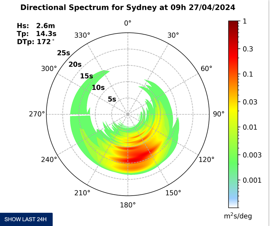
What gives Huey? Have you forgotten about your friends in Sydney? It looks as though the only thing you’ve done since yesterday morning is to bump the direction toward the SE. Otherwise it looks as though you’ve left pretty much everything else the same: average swell height is a metre and the period’s still only 7 seconds.
So…
Y’know yesterday? Yeah, kinda like that…
So, here’s the Bureau’s call for our region:
Saturday until midnight: Wind: N/NE 8/13 knots. Sea: about 1 metre. Swell: E/SE about 1 metre.
Sunday: Wind: N/NE 10/15 knots increasing to 15/20 knots in the afternoon. Sea: 1 to 1.5 metres rising to 2 metres in the afternoon.Swell: E 1 to 1.5 metres.
Monday: Wind: N/NE 10/20 knots.
To the extent there is any good news, it appears that we’re near the bottom of the curve and just maybe there will be a slight improvement over the weekend. But we are talking going from microscopic to just barely catchable, so not a huge prospect.
Right now the next week is looking sideways. Not going totally flat, but not pushing much above what we’ve had for a couple weeks now. The Bureau is saying that we may see a cyclone form up off Queensland, but it’s a very long way from that to a pumping NE swell in Sydney! The models are showing quite a bit of activity in the Coral Sea and off to the east of there, but none of it seems likely to get down our way this week. Could be pretty fun in SE Qld though with a steady supply of easterly windswell (fair amount of SE wind with it).
I’ll go looking for pictures later today, so stay in touch!


