
Hello Friends,
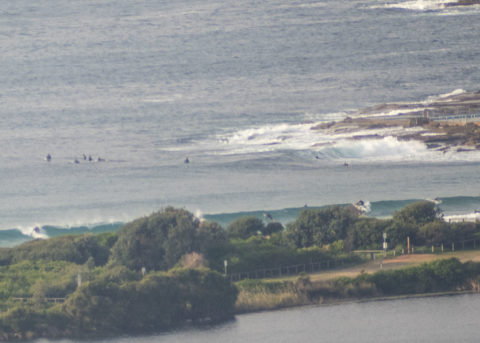
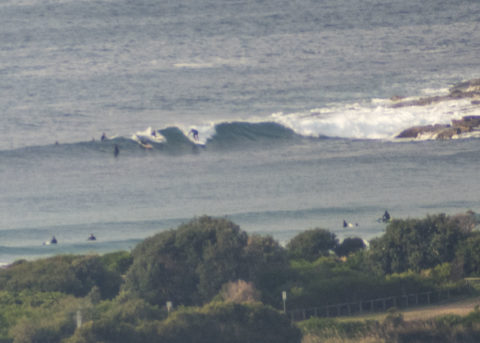
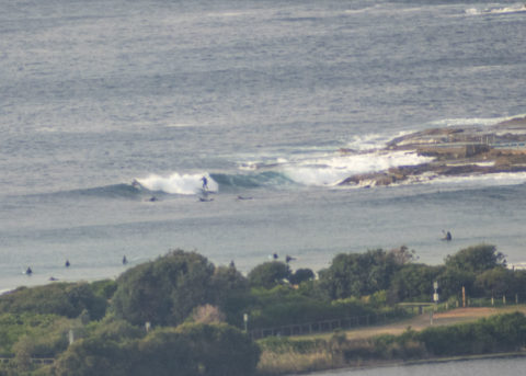
As expected, the energy levels have decreased again overnight and Sunday morning saw knee to waist high lines appearing every now and then. Fair number of hopefuls in the water under mostly overcast skies and with relatively mild temps. Out at sea the buoys were seeing 1.5 m of 9-10s energy from 152° (SE). Wind was coming lightly from the west. Ocean is still on 20C.
The swell models are showing a little uptick in energy later in the day but it’s probably not going to be too dramatic – I’d be hoping for maybe an improvement into the waist to chest at Dee Why. The problem is that the wind will likely come up from the south and then stay that way through tomorrow – when it’s likely to be rainy as well.
Go well!
Weather Situation
A high pressure system over the Bight currently extends a ridge across New South Wales, and is expected to slowly move east over the next few days. Meanwhile, a cold front that slipped to the south of the state yesterday will leave a weak low pressure trough lingering near the New South Wales coast on today. This trough is forecast to decay early in the new week, as the high pressure system makes its way to the Tasman Sea.
Forecast for Sunday until midnight
Winds
Variable about 10 knots becoming southerly 10 to 15 knots in the evening.
Seas
Below 1 metre.
Swell
Southerly 1.5 metres.
Weather
Partly cloudy. 80% chance of showers. The chance of a thunderstorm this evening.
Monday 8 June
Winds
Southerly 15 to 25 knots turning southeasterly 10 to 15 knots in the evening.
Seas
1 to 2 metres.
Swell
Southerly 1.5 metres.
Weather
Cloudy. 95% chance of showers. The chance of a thunderstorm.
Tuesday 9 June
Winds
Southeasterly 10 to 15 knots turning east to northeasterly below 10 knots during the afternoon.
Seas
Around 1 metre.
Swell
Southerly 1 to 1.5 metres.
Weather
Partly cloudy. 50% chance of showers.


