Hello Friends,
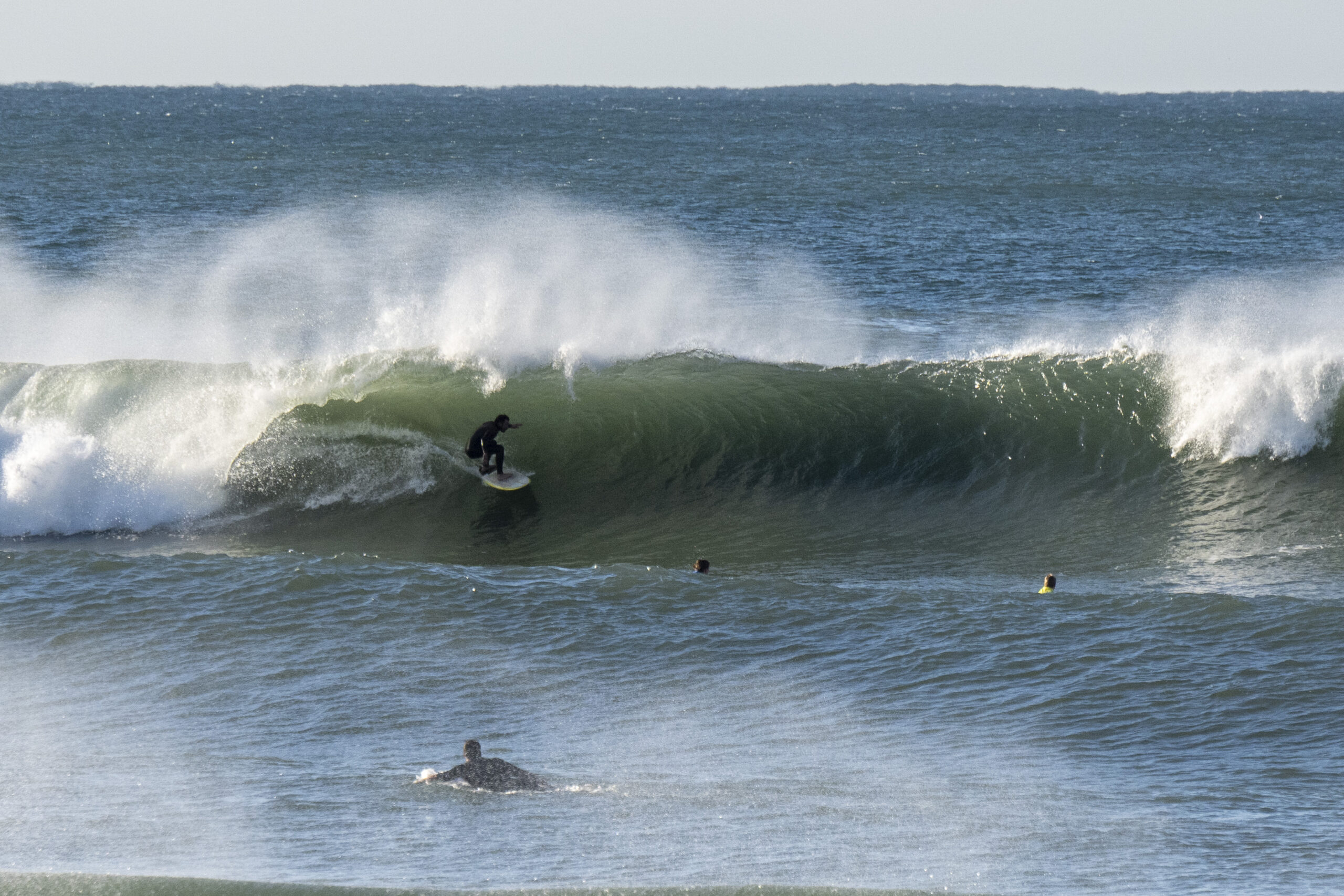
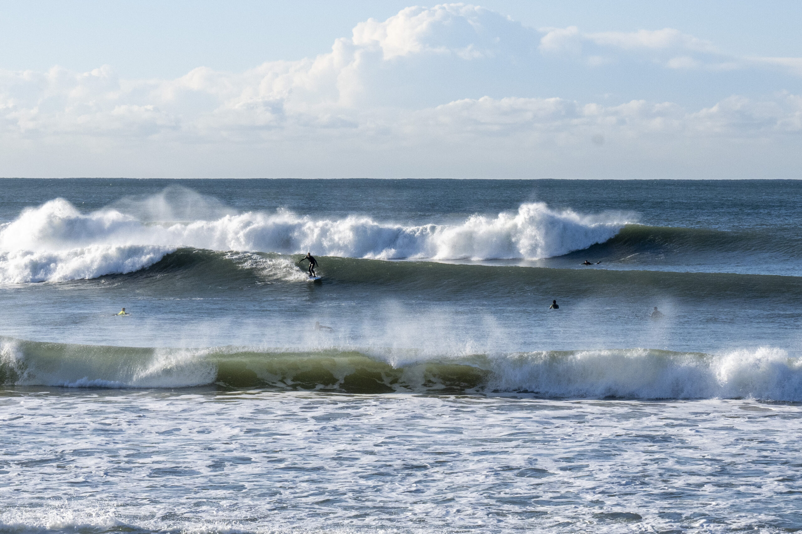
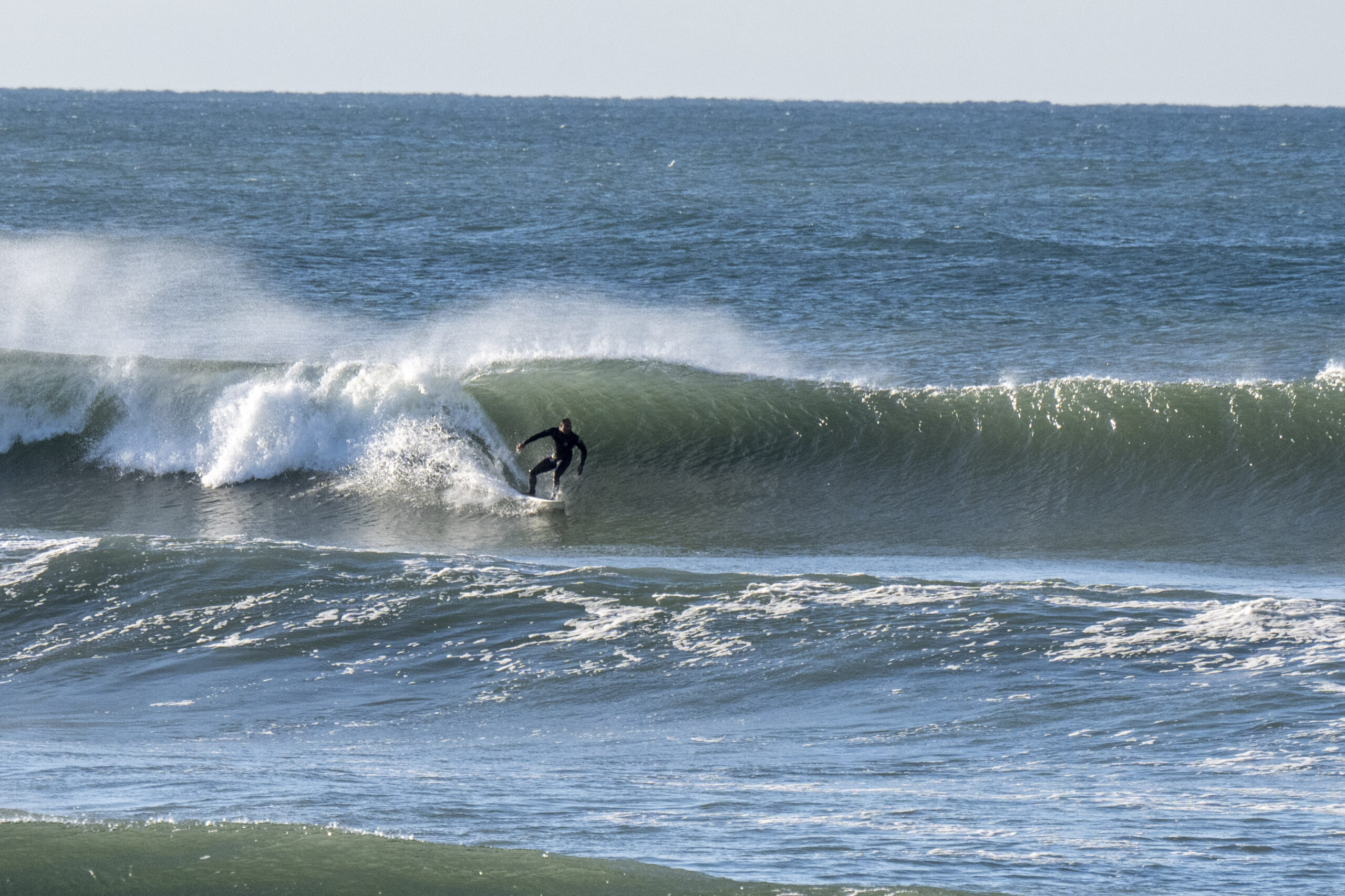
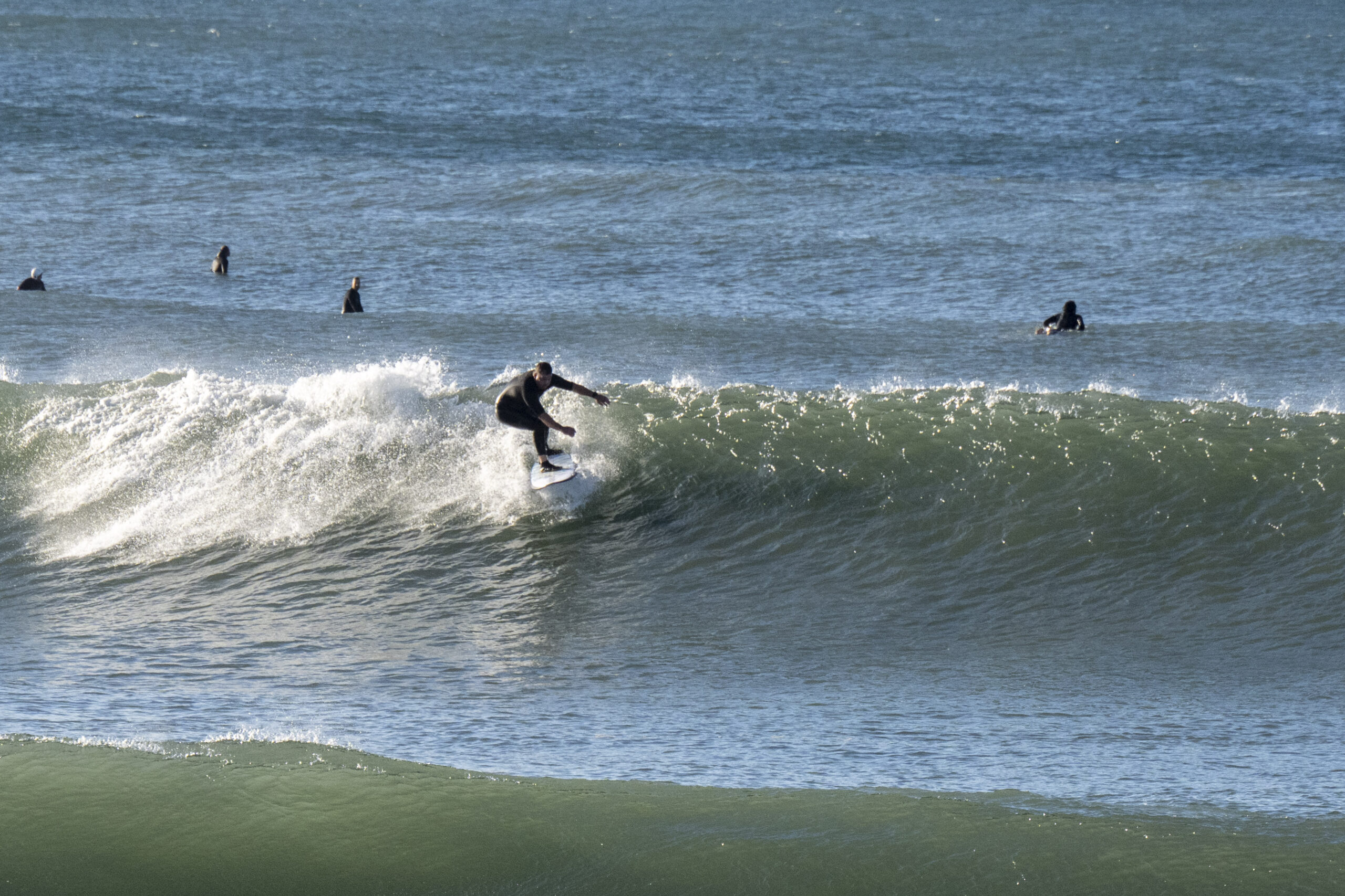
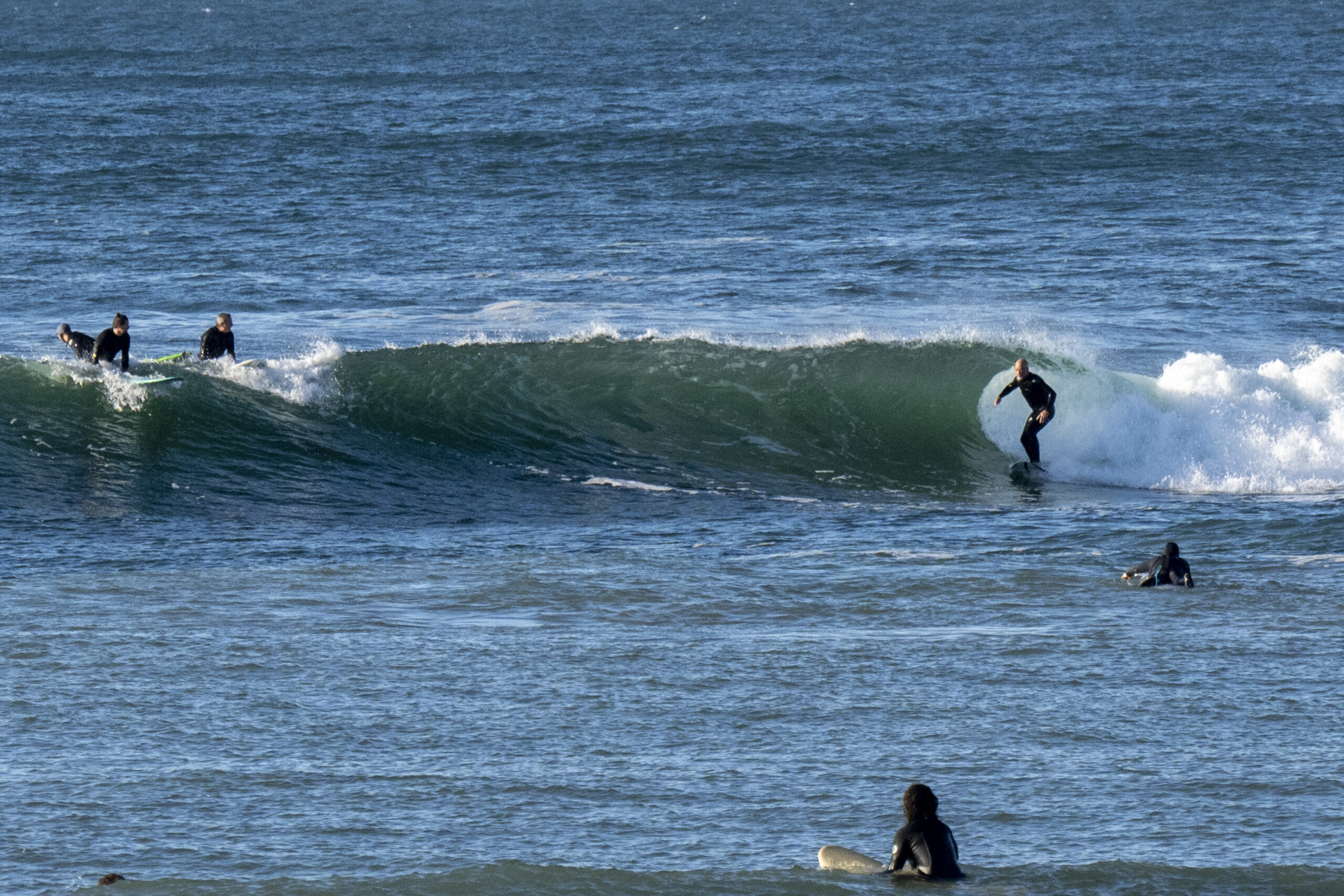
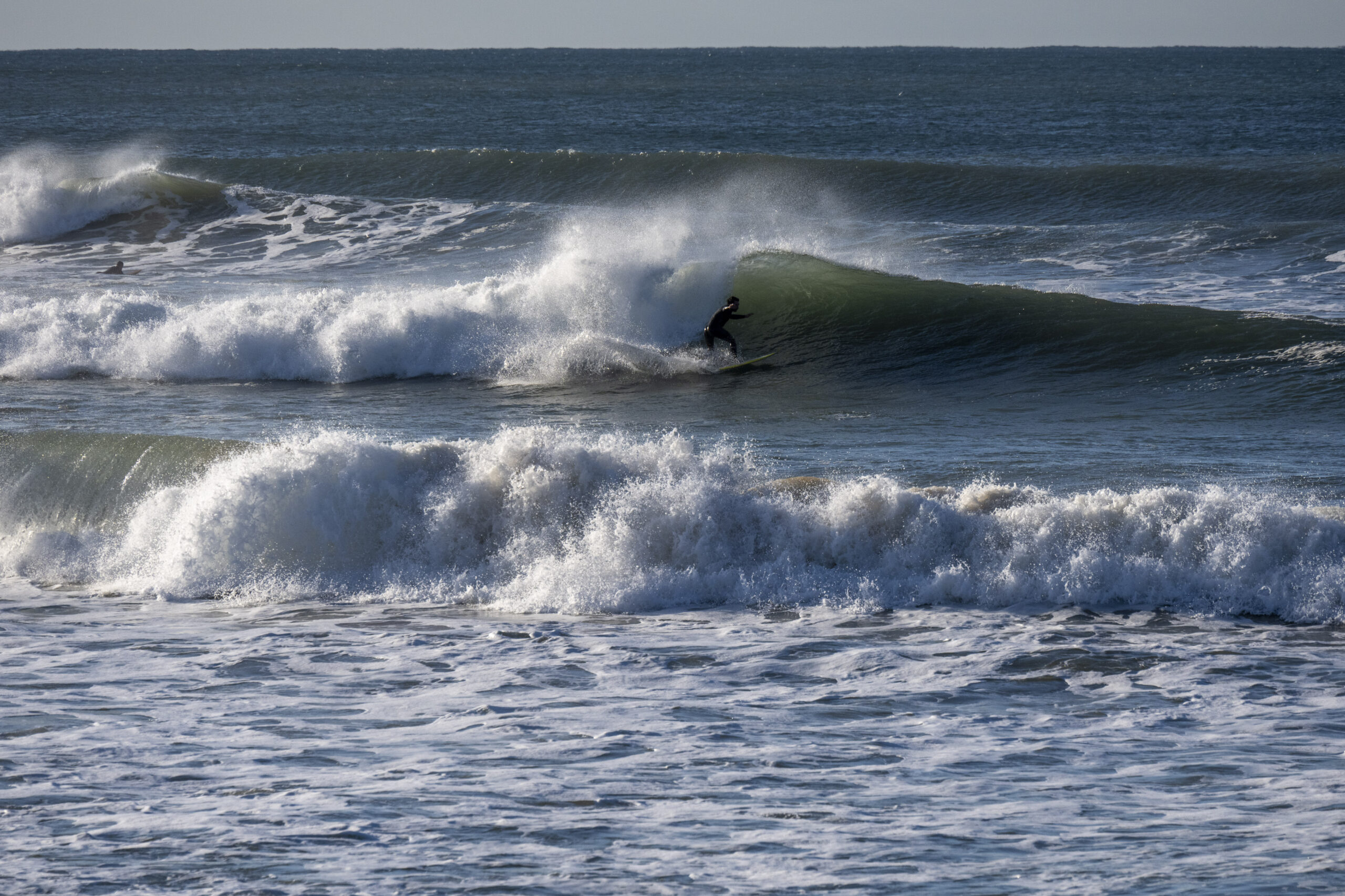
Up early for a run into the city, so not back to the beach until 9ish. As you can see from the pics, Dee Why had waves. These of course were what the sets looked like. It was pretty consistent at the beach, but much less so at the point. The last swell seems to have created a bank about 100m off the beach, just north of the club. It’s roughly where the legendary super peak formed briefly years ago. We’ll have to see how it looks after the big pulse due to hit tomorrow and last through Tuesday am. Today, even on low tide, it was mostly pretty fat. Waves would peak around 200m offshore, but by the time they were about 50-100m out, it looked like they were getting swallowed by a gutter.
The swell’s supposed be 5 metres from the south by midday tomorrow, but the Bureau says the wind will swing SW to SE and be 20-25 kts. Oh, and there’s a 100% chance of rain with it. So, yeah, maybe not.
Monday may be a better shot for the fit and keen as the wind’s due to swing back SW and the swell should still be chugging along at 3-4 metres.
Have a great Saturday everyone.
Oh, and mask up inside because cases are going up as the new variant takes over. On Thursday 346 folks reported coming down with it in our LGA. They brought the weekly total to 2847 cases. There is no evidence that repeated infections are good for you in any way.
Weather Situation
A low pressure system near New Zealand will continue moving east, while a high south of the Bight extends a ridge into northern and western New South Wales. A trough will cross the state’s southeast today and move north along the remainder of the coast tomorrow, after which the high is forecast to drift across eastern Australia. A cold front looks set to cross from west to east during Tuesday, before another high becomes established in the region.
Forecast for Saturday until midnight
Strong Wind Warning for Saturday for Sydney Coast
- Winds
- Southwesterly 20 to 30 knots.
- Seas
- 1.5 to 2.5 metres.
- 1st Swell
- South to southwesterly 2 to 3 metres.
- 2nd Swell
- Southeasterly around 1 metre, increasing to 1.5 metres later in the evening.
- Weather
- Partly cloudy. 90% chance of showers. The chance of a thunderstorm during this afternoon and evening.
Sunday 10 July
Strong Wind Warning for Sunday for Sydney Coast
- Winds
- South to southwesterly 20 to 30 knots turning southeasterly during the day and easing to 20 to 25 knots in the evening.
- Seas
- 1.5 to 2.5 metres.
- Swell
- Southerly 2 to 3 metres, increasing to 4 to 5 metres during the morning, then tending southeasterly 5 metres around midday.
- Weather
- Cloudy. Near 100% chance of showers. The chance of a thunderstorm offshore.
- Caution
- Large and powerful surf conditions are expected to be hazardous for coastal activities such as crossing bars by boat and rock fishing.
Monday 11 July
- Winds
- South to southeasterly 15 to 20 knots tending south to southwesterly 10 to 15 knots during the day then becoming variable below 10 knots during the afternoon.
- Seas
- 1 to 2 metres, decreasing below 1 metre during the morning.
- Swell
- Southeasterly 4 to 5 metres, decreasing to 3 metres during the afternoon.
- Weather
- Partly cloudy. 60% chance of showers.


