Sunday swell
Hello Friends, Dee Why point and beach were already well populated at 0700 thanks to a set of near perfect conditions. Wind was light from the WNW and the SSE swell was around 2 metres at about 10 seconds Sets at the point were into the head high range on the bigger ones and it […]
Longy Tuesday evening session

Went down to Longy toward dusk to see what was what. Lotta people in the water chasing big and lumpy high tide waves from about the guard hut north. Sets were still into the double head plus range, but there weren’t heaps of long ones. Few bods out the back too… Took a buncha pictures, […]
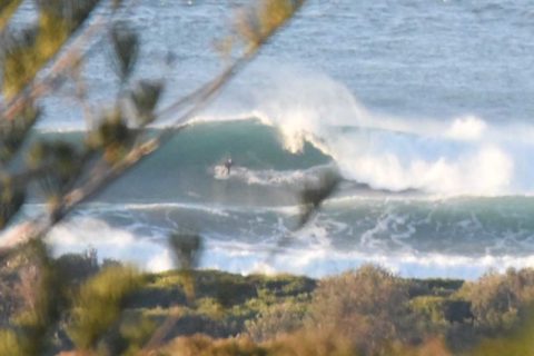
Thumping swell again this morning
Hello Friends, Swell’s expected to drop later today but at 0630 it was still 3 metres from the SSE at 11 seconds and that meant triple overhead faces on the biggest catchable ones at the point. Plus there were a few bigger than that. The beach was out of control and surface conditions looked fairly […]
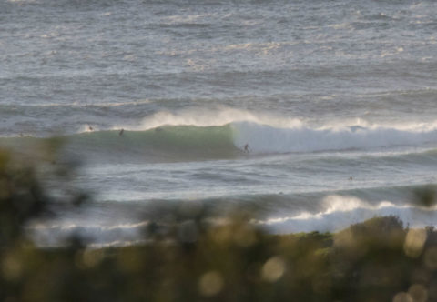
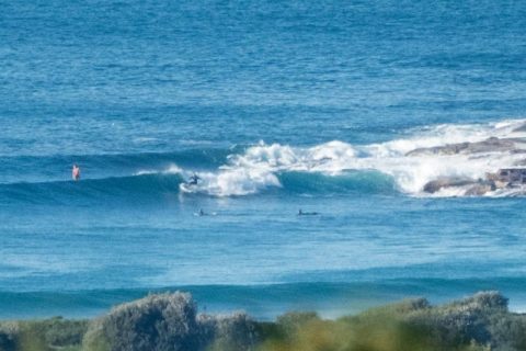
Sunday smooth and there are waves
Hello Friends, A touch over 2 metres of SE swell at about 10-sec apart rolling into Sydney’s beaches this morning. Dee Why point was seeing waist to chest plusses when I checked for the first time at 0800. At the time skies were overcast but not looking like raining immediately. Wind was light and from […]
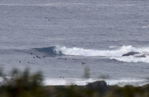
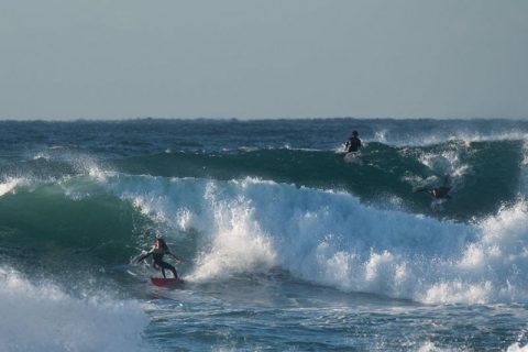
Pumping Friday morning
Hello Friends, As Friday gets started the swell is 2.2 metres and coming from the SSE at 12 seconds apart. That means double overhead faces on the sets up the beach and only a touch smaller at the point. As the pics show, there are quite a few waves in the sets and the point […]
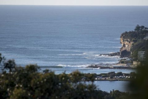
Pumping point for crazy Sunday crowds
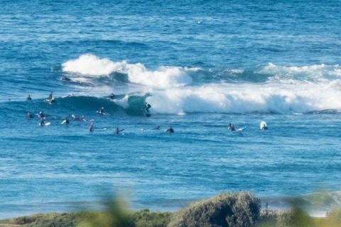
Hello Friends, Heaps of swell for heaps of people at the point by the time I looked at it for the first time around 0830. Sunny skies, light winds and, according to the MHL bouy data, a straight south swell that was (at 0600) a touch under 3 metres at 9 seconds. Tide was just […]
Big and raw at exposed stretches
Hello Friends, On a schedule this morning, so just gonna get the pics up and maybe come back later for more thoughts (and pictures even). Swell’s close to 3 metres from the SSE and 10-11sec apart but looking pretty raw at the exposed spots like Dee Why. later! . . . . . . Weather […]
Thumping swell and bigger tomorrow
Hello Friends, Now that’s annoying. Went out and shot pics at a heap of spots for you this morning only to get home and find the memory card had carked utterly and completely. So they’re off to pixel heaven and you’re none the wiser. Sorry, but will just have to make do with the crowsnest […]
Postcards from Crescent

Hello Friends, Your correspondent started tapping out this note somewhere between Macksville and Coffs as we were making our way through an apparently endless sequence of roadworks slowdowns. Your tax dollars are definitely at work up this way. Stayed in Crescent last night. When we pulled in an hour or so before dark the skies […]
Clean looking start to the day
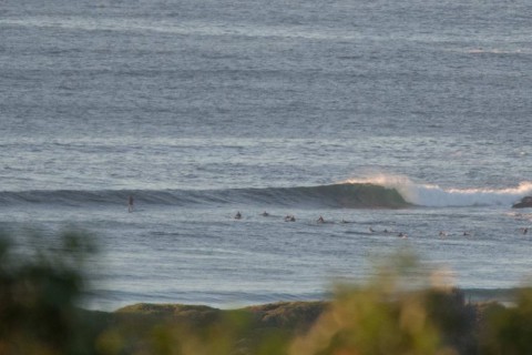
Hello Friends, Beautiful start to the day. Light offshore wind, mostly clear skies and a small but clean looking south line pulsing in. The MHL buoy data tells us it was south, 2 metres at 9 seconds as of 0500. Tide was dropping to the low at 0850 and, as you might expect, the point […]