Junky here and there
Hello Friends, Saturday morning in Sydney saw 10 kts of steady southerly wind and lined up raw looking shoulder plus south swell under mostly cloudy skies. The wind was chewing it up anywhere with south exposure but the thanks to being 4m at 10 seconds out at sea, the swell was comparatively cleaner in the […]
Drifting into the doldrums

Hello Friends, Not great numbers to start with this Tuesday. About a metre of 8-sec south wind swell showing on the MHL Sydney buoy and 10-15 kts of ESE wind along the coast. Throw in a high tide at a little after 1000 and I’m not overconfident about the wave prospects for you. Ankle to […]
Monday surf day both sides
Hello Friends, About 1.5 metres of 9-sec period SSE swell coming in for the early in Sydney. Well exposed spots should be in the waist to shoulder range on sets. Wind was west at 0630 and with luck will stay light all morning before going east this afternoon. Next tide is a low at 1120. […]
Here a bit better than there
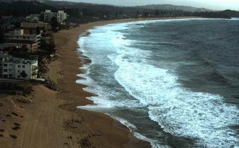
Hello Friends, Running a bit late today. Looks like Sydney’s not doing much surfwise. Hardly any swell showing on the MHL buoy and stiff 20+ kt NW wind should mean marginal knee to waist at places that like the metre or so of 9-sec period SE swell. Monday for the early looks like a bit […]
Looks interesting early
Hello Friends, Interesting combo swell this morning in Sydney. The MHL buoy is showing 2 metres at 12 seconds from the SE along with 1-1-5 metres of 6+ sec NE wind bump. Tide’s low around 0800 and the day promises to be abnormally warm (again). Wind’s north early and will pick up as the day […]
Dribble but not totally hopeless
Hello Friends, Light offshores and a weak short period combo of south and south-east swell washing into Sydney’s beaches this morning. The MHL buoy was showing 1.5 metres or so of 8-ish second bump, so there should be knee to maybe waist and bit little things at the magnet spots. Tide started coming back in […]
Lake Pacific – again
Hello Friends, Looks like surfing isn’t really on the agenda this morning, or indeed today. Wind was already ESE 9-10 kts by daybreak and the Bureau says it’ll continue like this through the afternoon. The MHL Sydney buoy is showing about a metre of 6 second period SE wind swell. That likely means nothing above […]
Another Real Surf… and little waves
Hello Friends, Checking out the coast south of Los Angeles and just north of San Diego when we came across another Real Surf in the surf town of Oceanside. Owner Shawn Ambrose knew all about us too. If you want to see what he’s doing, check out his online shop at realsurfshop.com. And, if you […]
Hello Friends, At the chaotic end of my trip, hence lack of peeps from me. Looks like a pretty ordinary sort of conditions in Sydey this morning with only short period wind swell from the south. With luck though it will be sort of doing something to lure the super keen… tomorrow afternoon looks a […]
Hello Friends, Radar showing a few showers around as Sydney sets off on Monday. Swell has gone back to the south and is a couple metres at sea, but the period’s a marginal looking 8 seconds. Throw in 20 kts of NE’r already and it has the look of a day with restricted surf options. […]